National Park De Biesbosch
| National Park De Biesbosch | ||
|---|---|---|
|
|
||
| Location: | Noord-Brabant , Zuid-Holland , Netherlands | |
| Next city: | Dordrecht | |
| Surface: | approx. 9000 ha | |
| Founding: | 1994 | |
| National park map | ||
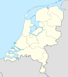
The National Park De Biesbosch (also Biesbos ) is a nature reserve in the Netherlands . It is located in the province of Noord-Brabant with a share of 97 percent and in Zuid-Holland with 3 percent . The Amer is its southern border .
history
In the Middle Ages, the area was part of the "Land van Heusden en Altena" and was a fertile pasture area. The dikes, which were supposed to protect the land and its inhabitants from the water from the rivers and the sea, were poorly maintained and controlled. On November 19, 1421, this part of the Netherlands was hit by a flood disaster .
At that time, the broad Hollands Diep and also the impenetrable marshland "de Biesbosch" (= rush forest) emerged. The distance to the North Sea was so short that the tide allowed the sea water to flow into de Biesbosch at high tide . The tidal range (difference in height between ebb and flow) was only two meters here. The result was a plant and animal life adapted to brackish water . Man harvested rushes and later, when a higher part of the area dried up, reeds .
In the 16th and 17th centuries, the eastern part of this area was wrested from the water by dikes. Efforts to dike the entire area, however, were thwarted early by nature conservationists.
During the Second World War, especially in the winter of 1944/1945, the Biesbosch provided shelter for partisans. The area, which is difficult to access and difficult to control, was used for smuggling weapons and stockpiling for resistance fighters.
On the occasion of the storm surge of February 1, 1953, which claimed more than 1,800 lives, it was decided to build the Delta Works . After the dam in the Haringvliet west of Hollands Diep was completed in 1970, no more salt water could flow from the North Sea into the Biesbosch. The character of the nature reserve changed gradually. In order to ensure the drinking water supply of Rotterdam , drinking water basins were created, which are filled with purified Maas water.
In 1994 the Biesbosch was declared a national park. Twelve kilometers west-southwest of Werkendam and to be reached from this village is the Biesbosch Museum, a visitor center.
See also
- Passenger ship Halve Maen
Web links
- National park website (Dutch, English)
- Website of the Biesbosch MuseumEiland (Dutch, German, English, French)


