Washington Slagbaai National Park
The Washington Slagbaai National Park ( Dutch: Washington Slagbaai Nationaal Park; Papiamentu : Parke Nashonal Washington Slagbaai; English: Washington Slagbaai National Park) is a national park on the island of Bonaire in the Caribbean .
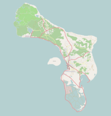
The park is located in the northwest of Bonaire. The area consists of dunes , beaches , mangroves , salt pans (salt lakes) and forest . The sanctuary of the former Washington plantation, including the natural harbor Slagbaai (slaughter bay), covers an area of around 5,643 hectares. The park was established in 1969.
The “Slagbaai” and “Goto” salt pans were designated as an international protected area by the Ramsar Convention in 1971. In the national park is the highest mountain on the island, the Brandaris , with a height of 241 meters.
The management and supervision is in the hands of the National Parks Foundation Bonaire (STINAPA), which also administers the Bonaire National Marine Park . The visitor center at the entrance of the park offers an insight into the eventful history of the use of the former plantation.
Flora and fauna
The flora includes around 340 species. Many of the plant families (approx. 40%) are represented by only one single species. The salt pans are a special area and home to the flamingos, for whom a sanctuary has been established for the construction of their mud nests.
The yellow-shouldered parrot is one of the specially protected parrot species . The chance for the chicks to survive in the nest is very slim. Rats, wild cats and other birds all eat the eggs, but the greatest danger is humans. They take the chicks out of their nests to sell. The trade is now prohibited by an international convention (CITES). Since 2008 the population has increased again.
Web links
Coordinates: 12 ° 16 '19.2 " N , 68 ° 22' 58.8" W.


