Sallandse Heuvelrug National Park
| Sallandse Heuvelrug National Park | ||
|---|---|---|
|
|
||
| Location: | Overijssel , Netherlands | |
| Next city: | Nijverdal | |
| Surface: | approx. 3500 ha | |
| Founding: | 2004 | |
| Address: | Willem-Alexanderstraat 7 NL-7442 MA Nijverdal |
|
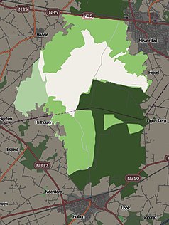
| National park map | ||
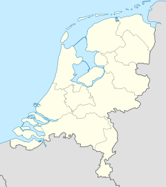
The Sallandse Heuvelrug National Park (German Sallander hill ridge) is a nature reserve in the Dutch province of Overijssel with a size of approximately 3500 hectares. The area received official status as a national park in 2004 and is mainly home to heathland and inland dunes .
geography
The Sallandse Heuvelrug National Park is located in the province of Overijssel in a triangle between the trunk roads (Dutch provinciale Weg) N35 in the north, N332 in the south-west and N350 in the south-east, the closest village is Nijverdal, which is immediately to the east.
Since the Middle Ages , the originally wooded area has mainly consisted of extensive heather areas, and in places the subsoil is completely devoid of any vegetation. In these places there are inland dunes created by sand drifts. As the name Sallandse Heuvelrug already suggests, the area of the national park is quite hilly by Dutch standards, the highest point of the park is the 75 meter high Grote Koningsbelt , which is also one of the highest places in the province.
In order to counteract further erosion and the formation of drifting sand, the hills were largely afforested with pine trees from around the end of the 19th century . This practice was discontinued towards the end of the 20th century in order to preserve the historically important heathland.
In the west of the national park is the De Sprengenberg country house , built between 1900 and 1910, on the hill of the same name. This is also called Palthetoren by the inhabitants of the region (after the Dutch patrician family of the Palther and the Dutch word toren for tower) and has the official status of a rijksmonument .
The hill ridge is a striking feature of the Overijssel landscape. The individual hills are visible from all directions from a great distance.
Emergence
The Sallandse Heuvelrug in its current form is a so-called ice edge layer that was formed during the Saale Ice Age about 150,000 years ago. Before the beginning of this Ice Age, the prehistoric Rhine and other large rivers deposited large amounts of gravel and sand as well as thinner layers of clay . During the Ice Age, the advancing glaciers pushed these deposits up and in front of them, which led to the formation of today's ridge at the point of the southernmost expansion. During the later Vistula Ice Age , the glaciers no longer penetrated into what is now the Netherlands, but the subsoil in the area of the later national park was permanently frozen , which prevented melt water from seeping into the ground. Instead, the water collected in streams on the surface and contributed to increased erosion. On the exposed ground, the prevailing strong winds deposited deck sand on the flanks of the ridge.
After the climate warmed up again, a thick forest began to form on the Sallandse Heuvelrug, which was the predominant form of vegetation until the Middle Ages. Due to the increasing population pressure during this time, extensive deforestation and intensive agricultural use of the area for grazing with sheep and goats began. This management led to the emergence of today's typical heather areas in the area.
flora
The Sallandse Heuvelrug National Park offers not only the dominant heathland but also areas with coniferous and deciduous forests . Some notable plants that occur in the heather are, for example, the black crowberry , the quendel silk , the common juniper or the cartilage . In the slightly more humid areas, the moor lily , the rib fern , the dog violet and various types of orchids grow . The park is home to a unique fungal flora , especially the increase in real chanterelles , which has been observed for several years.
fauna
Mammals
The largest mammal in the Sallandse Heuvelrug National Park is the roe deer , and foxes and stone marten also live here . The transition areas between forest and agriculturally used areas provide a habitat for the European polecat , ermine and weasel , among others . Different species of bats also live in the national park and mainly use hollow trees as retreats and camps for hibernation .
Reptiles and amphibians
The Sallandse Heuvelrug is home to only a few species of reptiles and amphibians , including mainly the blindworm and some frogs . The sand lizard , which is on the red list of endangered species , also lives in the park area. Tourism in the area is a significant problem for the lizards as dozens of animals are killed each year by careless visitors.
Birds
More than 75 different species of birds breed in the national park each year. These include rare species such as the stonechat , the goat milker and the common raven . The remaining stocks of old coniferous forests are the habitat of species such as the coal tit , the crested tit , the crossbill and birds of prey such as the hawk and the honey buzzard . In the deciduous forests one can observe the small woodpecker , the grosbeak or the nuthatch , among others .
Black grouse
A distinct feature of the Sallandse Heuvelrug National Park is the resident black grouse population . This species was practically extinct in the Netherlands, only about ten individuals remained on the Sallandse Heuvelrug. In order to preserve the species here, a total of 30 animals were captured in Sweden in 2012 and 2013 , where the species is still abundant and released on the Sallandse Heuvelrug. Between 2016 and 2021, another 25 animals will be introduced from Sweden each year to ensure the population's reproductive capacity in the future.
insects
The park area is home to a wide variety of insect species , including an extremely wide variety of butterflies . Some representatives are, for example, the green hairstreak , the brown-spotted mother-of-pearl butterfly or the small fire butterfly . The wasp spider has returned to the national park for a relatively short time .
Attractions
Holten Canadian War Cemetery
On the Holterberg is the Holten Canadian War Cemetery , which is maintained by the Commonwealth War Graves Commission . This is one of the largest military burial grounds in the Netherlands with a total of 1,394 soldiers' graves. In addition to 1355 Canadians, 36 British, two Australians and one Belgian are buried here. The soldiers buried at this place belonged to the 2nd Canadian Corps and lost their lives during the liberation of the Netherlands and in later battles in Germany. A new information center has existed here since 2011.
Twilhair Monument
Since October 2, 2003, a monument has been located near the village of Hellendoorn, which commemorates the Jewish forced laborers of the Twilhaar labor camp . These were first taken to the Westerbork transit camp by the German occupiers on October 2, 1942 and later died in the Auschwitz concentration camp . The memorial consists of a bronze plate with the names of the murdered engraved on it and two concrete panels with identical photos. One of these photos is intentionally faded, which the artist uses to draw attention to the possible fading of memories of these men.
Observatory
To the east of the national park near Nijverdal is an information center of the Dutch forest administration Staatsbosbeheer , where visitors can find out about the history and nature of the national park. Part of this center is also the Hellendoorn Publiekssterrenwacht , an observatory open to the public that was relocated here on April 19, 2013. Previously, this was housed in the nearby former grain mill De Wippe . The observatory makes use of the relatively low light pollution on the edge of the national park.
Web links
Individual evidence
- ↑ National Park De Sallandse Heuvelrug. In: beleefrijssenholten.nl. Retrieved August 6, 2018 (Dutch).
- ↑ a b A.J. Haarsen: Naam regio: Salland. In: cultureelerfgoed.nl/. Ministerie van Landbouw, Natuur en Voedselkwalitei, accessed on 6 August 2018 (Dutch).
- ↑ De Sprengenberg in Haarle. In: rijksmonumenten.nl. Retrieved August 6, 2018 (Dutch).
- ↑ Het ontstaan van de Sallandse Heuvelrug. In: sallandseheuvelrug.nl. Retrieved August 6, 2018 (Dutch).
- ↑ a b National Park De Sallandse Heuvelrug. In: entoen.nu. Retrieved August 6, 2018 (Dutch).
- ↑ a b c Flora and Fauna. In: sallandseheuvelrug.nl. Retrieved August 6, 2018 (Dutch).
- ↑ Simon Dirk Terpstra: Jaarlijks tientallen beschermde reptielen gedood door recreanten in Nationaal Park. In: rtvoost.nl. December 25, 2017, accessed August 6, 2018 (Dutch).
- ↑ Toekomst voor korhoender: elk jaar 25 dieren naar Sallandse Heuvelrug. In: tubantia.nl. April 6, 2016, accessed August 6, 2018 (Dutch).
- ↑ Leo Lensen: Holten Canadian War Cemetery. In: tracesofwar.com. Accessed August 6, 2018 .
- ↑ Teije Terhorst, Paul Moerenhout: Monument Rijkswerkkamp Twilhaar. In: tracesofwar.nl. Retrieved August 6, 2018 (Dutch).
- ↑ history. In: sterrenwachthellendoorn.nl. Retrieved August 6, 2018 (Dutch).


