Nochistlán
| Nochistlán | ||
|---|---|---|
|
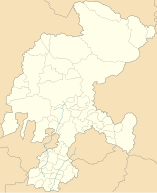
Coordinates: 21 ° 22 ′ N , 102 ° 51 ′ W Nochistlán on the map of Zacatecas
|
||
| Basic data | ||
| Country | Mexico | |
| State | Zacatecas | |
| Municipio | Nochistlán | |
| City foundation | 1532 | |
| Residents | 27,932 (2010) | |
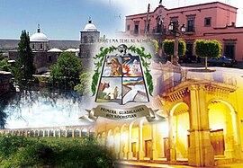
| City insignia | ||
| Detailed data | ||
| surface | 6.2 km 2 | |
| Population density | 4,505 inhabitants / km 2 | |
| height | 1875 m | |
| Nochistlán - photomontage | ||
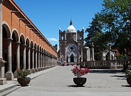
| San José Church and El Parián Market Hall | ||
| El Parián market hall | ||
Nochistlán or Nochistlán de Mejía is a small town with around 17,000 inhabitants and the capital of a municipality ( municipio ) of around 28,000 inhabitants in the Mexican state of Zacatecas, which consists of several villages and haciendas . In 2012 Nochistlán was added to the list of Pueblos Mágicos .
Location and climate
The city of Nochistlán is located in the south of the state of Zacatecas approx. 550 km (driving distance) northwest of Mexico City at an average altitude of approx. 1875 m ; the city of Zacatecas is a good 230 km north. The climate is temperate to warm; Rain (approx. 700 mm / year) falls predominantly in the summer half-year.
Population development
| year | 2000 | 2005 | 2010 |
| Residents | 15,499 | 15,322 | 16,562 |
The slight but steady increase in population of the city is mainly due to the ongoing immigration of families from the surrounding villages.
economy
Ores were mined in the vicinity of the village until the 19th century; other settlers founded large haciendas . Livestock breeding (cattle, sheep, goats, pigs) plays the most important role in the life of the community today; In addition, the cultivation of grain (maize, wheat, barley) and the cultivation of fruit and vegetables (beans, chillies, tomatoes, prickly pears, peaches, pears, figs, etc.) are important. Small traders, craftsmen and service providers of all kinds have settled in the city itself.
history
Until around the year 1000 the area belonged to the settlement area of the warlike tribe of the Texueks , a subgroup of the Chichimecs , but these were subjugated by the Zacatecs and Guachils . Around 1500 the area belonged to the sphere of influence of the semi-nomadic tribal group of the Caxcán . The place founded by the Conquistador Nuño Beltrán de Guzmán in 1532 under the name Villa de Guadalajara was a little off the main trade routes. In the years 1540 to 1542 it came to the Mixtón War because of the violence of the Spaniards in western New Galicia ; the leader of the uprising in the Nochistlán area was a chief named Tenamaxtle . In the suppression of the uprising, Pedro de Alvarado , one of the most important conquistadors in Mesoamerica , was fatally wounded. Only through the personal commitment of the then Viceroy Antonio de Mendoza was it possible to end the uprising in 1542 with the help of Tlaxcaltek auxiliary troops. In the following years the Spaniards - with the exception of the missionaries - were forbidden from entering the region for a long time by papal decree.
Attractions
- Churches of San Francisco de Asís , San Sebastián and San José
- El Parián market hall
- Los Arcos aqueduct
- Statue of Chief Tenamaxtle
- outside
- The colonial church of San Agustín is located in the village of Tlachichila


