Upper Riedberg
| Upper Riedberg | ||
|---|---|---|
|
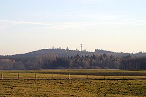
Northwest view from the Upper Riedberg |
||
| height | 686.2 m above sea level NHN | |
| location | Bavaria , Germany | |
| Coordinates | 48 ° 3 '5 " N , 10 ° 48' 14" E | |
|
|
||
| rock | Nagelfluh | |
| Age of the rock | Ice Age | |
Oberer Riedberg is the name of the highest point on a striking ridge in the Upper Bavarian district of Landsberg am Lech .
Location and surroundings
The Obere Riedberg is located about five kilometers west of the Lech , between Buchloe and Landsberg am Lech in the area of the municipality of Igling . It forms the highest point of an approximately twelve-kilometer-long, wooded ridge west of the Lech in the Alpine foothills.
Surname
In the 19th century, the name Stoffersberg was used for the ridge . In today's official maps, however, the name Oberer Riedberg is used.
history
At the summit are the remains of the medieval Stoffersberg castle stables .
Others
To the south of the highest point is an approximately 50 m high steel lattice mast with cellular and directional radio antennas.
Individual evidence
- ↑ a b Federal Office for Cartography and Geodesy , State Office for Surveying and Geoinformation Bavaria : Digital Topographical Map 1:25 000, [1] , accessed on September 21, 2011
- ^ Original position sheet No. 708 of the Bay. Land survey from the 19th century [2]
- ^ Friedrich Wilhelm Walter: Topical geography of Bavaria. Verlag der literarisch-artisticischen Anstalt, Munich, 1844, p. 110.
- ↑ Bavarian State Office for Monument Preservation, Bayernviewer Monument Archived copy ( Memento of the original from August 17, 2011 in the Internet Archive ) Info: The archive link has been inserted automatically and has not yet been checked. Please check the original and archive link according to the instructions and then remove this notice.

