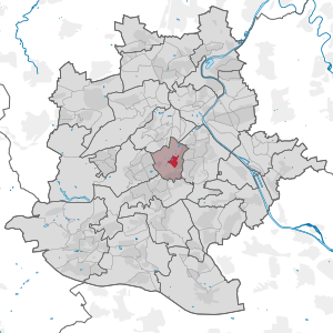
Upper castle garden
|
Upper Schlossgarten district of Stuttgart |
|
|---|---|
| Coordinates | 48 ° 46 '44 " N , 9 ° 11' 5" E |
| surface | 0.364 km² |
| Residents | 382 (May 31, 2020) |
| Population density | 1049 inhabitants / km² |
| prefix | 0711 |
| Borough | Stuttgart-center |
| Source: Stuttgart data compass | |
Oberer Schlossgarten is a district of Stuttgart . It is located in the city district of Mitte and extends with 36.4 hectares not only over the part of the palace garden of the same name .
As one of ten districts in the Mitte district, it is part of the inner city of Stuttgart. It bears the district number 101.
The district is divided into two parts by the B 14 . On the western side, the park, the New Palace with Palace Square, the square house of the state parliament and the opera and theater of the Stuttgart State Theater belong to the district. To the east of the main road there are other public facilities such as the State Gallery , the Wilhelmspalais or the Württemberg State Library, as well as residential buildings.
gallery
Fountain on the Schlossplatz
New castle at night


