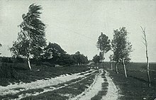
Oberndorfmark

Oberndorfmark is a district of the municipality-free area Osterheide in the district of Heidekreis , in the Lüneburg Heath ( Lower Saxony ). Oberndorfmark was the collective name of a community in Ostheidmark in the old district of Fallingbostel . Single yard settlements were typical in the Ostheidmark. They formed the community names under a collective term. To Oberndorfmark belonged u. a. Nordbostel, Neuhaus, Kronsnest , Kolk , Osterbostel (Küsterhof), Homannshof, Schusterkrug, Südbostel and the seven stone houses on the southern edge of the municipality .
history
Oberndorfmark is first mentioned in a document in the Lüneburg fief register in 1330. Certificate No. 105: "Arnd van muden (Müden) twene houe to muden unde enen hof to ouerendorpmarke." In 1360 in document no. 368: "Johan unde Cord brodere van muden ... unde enne hof to der ouendorpmarke." The district of Oberndorfmark originally only consisted of the Leverenzhof, the Soffeen (Soffeyer) and the Gehrkenhof, which is mentioned in the Lüneburg feudal register in 1470: No. 730: "Luderus hauichorst ... enen hoff to our Dorpmarke." In 1337 and 1338 the Kolk district was mentioned in the document book of the St. Johannis Walsrode monastery as "kolege" or "college" . The community name Oberndorfmark was only later adopted as the overall name for the entire peasantry.
The community belonged partly to the parish of Düshorn and partly to the parish Fallingbostel . The army and post roads ran through the community from Celle to Stade .
As everywhere in the Ostheidmark, the Oberndorfmarker pupils went to a so-called "row school" until 1793 . There was no permanent school building of its own. Lessons were held in the apartments of the courtyards every year. The owner of the crown nest often offered a free place to build a school. The way there was too long and difficult for most of them. In 1794 Peter Immwiehe (im Wiehe), the owner of the Gehrkenhof, which belongs to Gut Hilperdingen in Walsrode , sells a piece of land near the farm, on which a school building will be built. It is about halfway between Kolk and Osterbostel. Johann Casten Harms was a teacher from 1788 until his death in December 1834, first in the row school and then in the new school building.
In the course of the establishment of the Bergen military training area , the resettlement of the population and the evacuation of the entire area took place from summer 1935 to May 1936. The farm owners were compensated, the buildings were mostly demolished. (see Heidmark # Destruction of the Ostheidmark in the time of National Socialism ). The total size of the municipal area was 2071 hectares , 100% of which fell into the military training area.
Population development
Oberndorfmark had the following population development:
1770 - 146 inhabitants
1821 - 238 inhabitants
1933 - 210 inhabitants
Cultural monument
Web links
Single receipts
- ↑ Hans Stuhlmacher : The Heidmark. Louis Scheling, Walsrode Reprint from 1939.
Coordinates: 52 ° 50 ' N , 9 ° 46' E


