Oberruhn
Coordinates: 51 ° 2 ′ 33 ″ N , 8 ° 33 ′ 7 ″ E
Oberruhn (also Rügene ) is a submerged settlement in the area of today's town of Battenberg (Eder) in the Waldeck-Frankenberg district in Hesse .
location
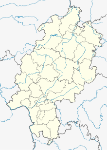
The place, the exact location of which is still unknown, was in the northwest of the district of Dodenau , about three kilometers east of Alertshausen , between the "Little Beech Prince" and the "Great Beech Prince", roughly in the area where the race in the Riedgraben (Ruhnbach) opens. The name “Kirchenstump” could refer to the place that has disappeared.
history
The place was first mentioned as Ruihena in 1059, when the settlement came to the parish of Elsoff. The noble landlord Buobo von Elsoff completed the split from the Raumländischen mother church in this year . In order to be able to hold mass, baptism and the intercession of the deceased in Elsoff, he transferred part of his lands to the church in Raumland. The localities Schwarzenau , Beddelhausen , Elsoff and Alertshausen appear in the corresponding document . The deserted villages of Gospershausen , Leinfe and Breitendelle can also be found there .
In the description of the national borders of June 14, 1561, the chapel in Reuen is mentioned. Around 1950 there were still remains of the church. The place probably went under due to its altitude and the associated lack of water.
literature
- Günther Wrede : Territorialgeschichte der Grafschaft Wittgenstein (= Marburg studies on older German history. Series 1: Work on the historical atlas of Hesse and Nassau. H. 3, ZDB -ID 506846-0 ). Elwert, Marburg 1927 (at the same time: Marburg, University, dissertation, 1927).
- Lars Womelsdorf: Contributions to the history of the village Alertshausen
Web links
- Oberruhn, Waldeck-Frankenberg district. Historical local dictionary for Hessen. In: Landesgeschichtliches Informationssystem Hessen (LAGIS).
Footnotes
- ↑ Mittelruhn and Niederruhn are also mentioned in historical documents.
