
Battenberg (Eder)
| coat of arms | Germany map | |
|---|---|---|

|
Coordinates: 51 ° 1 ′ N , 8 ° 39 ′ E |
|
| Basic data | ||
| State : | Hesse | |
| Administrative region : | kassel | |
| County : | Waldeck-Frankenberg | |
| Height : | 340 m above sea level NHN | |
| Area : | 64.73 km 2 | |
| Residents: | 5325 (Dec. 31, 2019) | |
| Population density : | 82 inhabitants per km 2 | |
| Postal code : | 35088 | |
| Area code : | 06452 | |
| License plate : | KB, FKB, WA | |
| Community key : | 06 6 35 004 | |
| City structure: | 4 districts | |
City administration address : |
Main street 58 35088 Battenberg |
|
| Website : | ||
| Mayor : | Christian Klein ( CDU ) | |
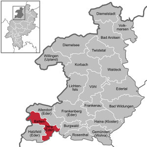
| Location of the town of Battenberg (Eder) in the Waldeck-Frankenberg district | ||
 _in_KB.svg) |
||

.JPG)
Battenberg (Eder) is a small town in the southwestern part of the northern Hessian district of Waldeck-Frankenberg .
The noble family of the same name , Battenbergkuchen and Battenberg markings are named after her.
geography
Geographical location
Battenberg is located in the Ederbergland , to which the castle forest bordering to the east belongs, on the southern edge of the Sauerland and the Rothaargebirge. It is 320 to 650 m above sea level. NN and is traversed by the Eder , whose river bed is protected north of the city by the nature reserve Ederknie am Auhammer . The closest medium-sized center is Frankenberg (Eder) , the university town of Marburg acts as the main center .
Neighboring communities
Battenberg borders in the north on the municipality Bromskirchen , in the northeast on the municipality Allendorf , in the southeast on the municipality Burgwald (all three in the district Waldeck-Frankenberg), in the south on the municipality Münchhausen ( district Marburg-Biedenkopf ), and in the west on the Cities of Hatzfeld (district of Waldeck-Frankenberg) and Bad Berleburg ( district of Siegen-Wittgenstein in North Rhine-Westphalia ).
City structure
The city consists of the core city and four surrounding villages:
- Battenberg, with the Neu-Jägersdorf (Kröge) settlement
- Berghofen
- Dodenau
- Frohnhausen
- Laisa
history
Castle, office and city of Battenberg
_De_Merian_Hassiae.jpg)

.JPG)

People already settled on the Eisenberg in the Celtic times . A branch of the dynasty of the Counts of Battenberg and von Wittgenstein (based at Wittgenstein Castle ) ruled the County of Battenberg from 1214 . Battenberg was first mentioned in writing in 1226 and named as a town eight years later (1234). In the early years of the 13th century, the cellar castle was built during the rule of Count Werner I von Battenberg and Wittgenstein or his son Widekind I (Widukind) , and the counts moved their residence from the old Battenberg castle to the cellar castle . In 1238 the counties of Battenberg and Wittgenstein were divided among the grandsons of Count Werner I : Widekind II received the Battenberg estates and Siegfried I received Wittgenstein Castle and the town of Laasphe . In 1291, Count Hermann II († 1314) von Battenberg, son of Widekind II, was forced by political pressure to sell parts of his county to the Archbishopric of Mainz: Castle and town of Battenberg and the courts of Laisa, Battenfeld and Münchhausen went into Mainz ownership over. The city and county of Battenberg (officially called "Grafschaft Stiffe") became the property of the Archbishops of Mainz in 1291 half and in 1296 completely .
In 1464, the Battenberg Office, which was formed from it, came to the Landgraviate of Hesse as pledge in the course of the Mainz collegiate feud , before it was completely assigned to Hesse-Marburg after the Merlau Treaty around 1583 . As a result of the extinction of the Marburg line , it came to the Landgraviate of Hesse-Kassel in 1604 and in 1624 as part of the so-called "Hinterland" to the Landgraviate of Hesse-Darmstadt . From 1821 to 1832 the city was the seat of the administration of the "Landratsbezirks" Battenberg, until it was incorporated into the newly created Biedenkopf district in 1832 .
The statistical-topographical-historical description of the Grand Duchy of Hesse reports on Battenberg in 1830:
“Battenberg (L. Bez. Gl. N.) city; is 11 hours north of Giessen on a hill, at the foot of which the Eder flows. 1456 Hess. (1120 Par.) Feet above the sea, has 144 houses and 954 inhabitants, who are Protestant except for 64 Jews. Battenberg, which is partly still surrounded by walls, is the seat of the district councilor, the rent office and the forest inspector, and there is 1 church, 1 town hall, 1 iron hammer, known as the Auhammer, 1 post office and in the area there are cracks of red sandstones. On the Eisenberg lie the ruins of Battenberg Castle, which in 1464 was still in good condition and the seat of the official; 1 ⁄ 4 St. from the city is 1832 Hess. (1409 par.) Feet above the surface of the sea, the Battenberger Warte, consisting of a round tower. 7 markets are held annually. - The area first became known in 778 through the defeat of the Saxons. The descendants of the Counts of Hohenlinden have been appearing since the last half of the 12th century, now under the name Count von Wittgenstein, now under the Count: von Battenberg. These counts not only owned the castles after which they were named, but they also made claims to the jurisdiction of other castles in the vicinity that belonged to the landgraves. In 1228 half of the castles of Battenberg and Kellerberg, the town of Battenberg, etc. between them came to the Archbishop Siegfried of Mainz for 600 marks. However, the matter was not carried out until 1238. In the case of the division, which was held in 1291 between Count Hermann von Battenberg and the ore monastery of Mainz, the Kellerberg castle, along with the courts in Allendorf, Rödenau and Bromskirchen, received the castle and town of Battenberg, along with the courts in Leisa and Battenfeld. A few years later, in 1297, the same Hermann sold the Kellerberg Castle and its accessories to the Mainz ore monastery for 2000 marks. Archbishop Heinrich von Mainz sold the town and castle of Battenberg to Count Otto von Waldeck in 1304, on repurchase, which also took place in 1464 when Archbishop Adolph von Mainz gave Battenberg to Landgrave Heinrich III. was offset by 30,000 fl . "
In 1866 Battenberg was annexed with the entire hinterland of Prussia. In 1932 Battenberg became part of the Frankenberg district . In the course of the Hessian administrative reform of 1974, the districts of Frankenberg and Waldeck were merged to form the district of Waldeck-Frankenberg .
The Battenberg / Mountbatten house
In 1851 Countess Julia Hauke , the morganatic wife of Prince Alexander of Hesse and by the Rhine , was given the grand-ducal Hessian prince status with von Battenberg , which should also extend to their common descendants. The couple thus became the founders of the noble family Battenberg / Mountbatten . Princess Victoria Eugénie von Battenberg was from 1906 to 1931 through her marriage to King Alfonso XIII. Queen of Spain. The family members living in Great Britain adopted the translated name "Mountbatten" from 1917 onwards due to the increasing hostility towards Germans during the First World War . This is now the family name of the Marquesses of Milford Haven , and he lives on in the title of Earls Mountbatten of Burma . The descendants of Queen Elizabeth II and her husband Prince Philip Mountbatten bear the family name Mountbatten-Windsor .
Territorial reform
On December 31, 1970, was in the course of administrative reform in Hesse until then independent municipality Berghofen voluntarily incorporated . On February 1, 1971, the communities of Dodenau and Laisa were added. Frohnhausen and Oberasphe followed on January 1, 1974 by virtue of state law. For all formerly independent communities and the core community, local districts with local advisory councils and local councilors were set up.
When in 1974 the districts of Frankenberg and Waldeck were combined to form the district of Waldeck-Frankenberg and the districts of Biedenkopf and Marburg to form the district of Marburg-Biedenkopf, Oberasphe became a district of Battenberg in the first-mentioned greater district on January 1, 1974, initially by state law. After violent protests by the population, however, six months later, on July 1, 1974, by virtue of state law, the town was incorporated into the large community of Münchhausen in the neighboring district of Marburg-Biedenkopf.
Outsourcing
On July 1, 1974, the Oberasphe district was ceded to the neighboring community of Münchhausen.
Territorial history and administration
The following list gives an overview of the territories in which Battenberg was located and the administrative units to which it was subordinate:
- around 1230: Holy Roman Empire , County of Battenberg, (city) court of Battenberg
- around 1400: Holy Roman Empire, Electorate Mainz , Amt Battenberg
- from 1464: Holy Roman Empire, Landgraviate of Hesse , Battenberg Office
- from 1567: Holy Roman Empire, Landgraviate Hessen-Marburg , Amt Battenberg
- 1604–1648: disputed between Hessen-Kassel and Hessen-Darmstadt ( Hessenkrieg )
- from 1604: Holy Roman Empire, Landgraviate Hessen-Kassel, Amt Battenberg
- from 1627: Holy Roman Empire, Landgraviate Hesse-Darmstadt , Upper Duchy of Hesse , Office of Battenberg
- from 1806: Grand Duchy of Hesse , Upper Duchy of Hesse, Office of Battenberg
- from 1815: German Confederation , Grand Duchy of Hesse, Province of Upper Hesse , Battenberg Office
- from 1821: German Confederation, Grand Duchy of Hesse, Province of Upper Hesse, District Battenberg (separation of justice ( district court Biedenkopf ) and administration)
- from 1832: German Confederation, Grand Duchy of Hesse, Province of Upper Hesse, Biedenkopf district
- from 1848: German Confederation, Grand Duchy of Hesse, Biedenkopf district
- from 1852: German Confederation, Grand Duchy of Hesse, Province of Upper Hesse, Biedenkopf district
- from 1867: North German Confederation , Kingdom of Prussia , Province of Hesse-Nassau , District of Wiesbaden , District of Biedenkopf (transitional hinterland district)
- from 1871: German Empire , Kingdom of Prussia, Province of Hesse-Nassau, District of Wiesbaden, District of Biedenkopf
- from 1918: German Empire, Free State of Prussia , Province of Hessen-Nassau, Administrative Region of Wiesbaden, District of Biedenkopf
- from 1932: German Empire, Free State of Prussia, Province of Hessen-Nassau, Administrative Region of Kassel , District of Frankenberg
- from 1944: German Empire, Free State of Prussia, Province of Kurhessen , District of Frankenberg
- from 1945: American zone of occupation , Greater Hesse , Kassel district, Frankenberg district
- from 1949: Federal Republic of Germany , State of Hesse , Kassel district, Frankenberg district
- 1974: Federal Republic of Germany, Land Hessen, Kassel , Waldeck-Frankenberg
population
From 1988 onwards, the population of Battenberg was relatively constant at 5,700 over a period of 20 years. Since then, it has been slowly declining in the course of demographic change and was 5479 after the 2011 census . Compared to older updates, however, the population increased by 90 inhabitants. According to the Bertelsmann Foundation , Battenberg is “demographic type 1”, that is, a location in the “Smaller stable rural towns and communities” category.
Population structure
According to the 2011 census , there were 5516 inhabitants in Battenberg on May 9, 2011. These included 257 (4.7%) foreigners, of whom 150 came from outside the EU , 87 from other European countries and 20 from other countries. The inhabitants lived in 2238 households. Of these, 586 were single households , 596 couples without children and 800 couples with children, as well as 212 single parents and 44 shared apartments .
Population development
| • 1502: | 46 citizens |
| • 1577: | 93 households |
| • 1712: | 94 households |
| • 1791: | 791 inhabitants |
| • 1800: | 779 inhabitants |
| • 1806: | 799 inhabitants, 129 houses |
| • 1829: | 954 inhabitants, 144 houses |
| Battenberg: Population from 1791 to 2015 | ||||
|---|---|---|---|---|
| year | Residents | |||
| 1791 | 791 | |||
| 1800 | 779 | |||
| 1806 | 799 | |||
| 1829 | 954 | |||
| 1834 | 1,171 | |||
| 1840 | 1,216 | |||
| 1846 | 1,363 | |||
| 1852 | 1,376 | |||
| 1858 | 1,361 | |||
| 1864 | 1,195 | |||
| 1871 | 1,001 | |||
| 1875 | 1,033 | |||
| 1885 | 1,028 | |||
| 1895 | 959 | |||
| 1905 | 956 | |||
| 1910 | 990 | |||
| 1925 | 1.010 | |||
| 1939 | 1,321 | |||
| 1946 | 1,851 | |||
| 1950 | 1,757 | |||
| 1956 | 1,660 | |||
| 1961 | 1,848 | |||
| 1967 | 2.164 | |||
| 1972 | 4,517 | |||
| 1975 | 4,979 | |||
| 1980 | 5,030 | |||
| 1985 | 4,975 | |||
| 1990 | 5,537 | |||
| 1995 | 5,693 | |||
| 2000 | 5,752 | |||
| 2005 | 5,640 | |||
| 2010 | 5,445 | |||
| 2011 | 5,516 | |||
| 2015 | 5,414 | |||
| Data source: Historical municipality register for Hesse: The population of the municipalities from 1834 to 1967. Wiesbaden: Hessisches Statistisches Landesamt, 1968. Further sources:; 1972 :; from 1975 :; 2011 census From 1972 including the towns incorporated into Hesse as part of the regional reform . | ||||
Religious affiliation
| • 1829: | 890 Protestant, 64 Jewish residents |
| • 1885: | 949 Protestant, 23 Catholic, 56 Jewish residents |
| • 2011: | 3868 Protestant (= 70.1%), 812 Catholic (= 14.7%), 836 other (= 15.2%) residents |
politics
City Council
The local elections on March 6, 2016 produced the following results, compared to previous local elections:
| Parties and constituencies |
% 2016 |
Seats 2016 |
% 2011 |
Seats 2011 |
% 2006 |
Seats 2006 |
% 2001 |
Seats 2001 |
||
|---|---|---|---|---|---|---|---|---|---|---|
| SPD | Social Democratic Party of Germany | 21.0 | 6th | 26.0 | 8th | 22.9 | 7th | 20.6 | 6th | |
| CDU | Christian Democratic Union of Germany | 18.9 | 6th | 20.7 | 6th | 24.4 | 8th | 25.0 | 8th | |
| BLLFB | List of citizens of the districts of Laisa, Frohnhausen and Berghofen | 17.9 | 6th | 18.1 | 6th | 15.5 | 5 | 15.3 | 5 | |
| SU | Citizen list city of Battenberg | 19.8 | 6th | 15.0 | 5 | 17.1 | 5 | 19.8 | 6th | |
| BLD | Citizen list Dodenau | 16.5 | 5 | 14.6 | 4th | 14.1 | 4th | 13.5 | 4th | |
| FDP | Free Democratic Party | 5.3 | 2 | 5.6 | 2 | 5.5 | 2 | 4.1 | 1 | |
| D&C | List of independent citizens in Berghofen | 0.6 | 0 | - | - | 0.5 | 0 | 1.7 | 1 | |
| total | 100.0 | 31 | 100.0 | 31 | 100.0 | 31 | 100.0 | 31 | ||
| Voter turnout in% | 51.7 | 51.8 | 49.6 | 55.6 | ||||||
mayor
After three legislative terms (18 years), Heinfried Horsel (non-party) decided not to run again. As his successor, Christian Klein, the son of the former District President Lutz Klein , was elected mayor on May 25, 2014 with 68.9% of the votes cast in the first ballot and took office on August 1, 2014.
coat of arms
Blazon : "Shield split by black and silver."
The coat of arms of the city could be one of the oldest coats of arms in Hesse. This can be assumed because Battenberg was already fully owned by the Archdiocese of Mainz as early as 1291 (half of it from 1238) and the colors, if the coat of arms had only been introduced at this time, would have been characterized by the colors red and white. It is therefore very likely that it dates back to the time of the Counts of Battenberg around the 12th century, i.e. from the prehistoric times of the coats of arms, when they were simple identification aids to make friends and foes easier on the battlefield due to the emerging armor to be able to distinguish. This derivation is supported by the simplicity of the design of the Battenberg coat of arms, since at that time not every city had a coat of arms and these therefore had to become more and more complicated in their development history in order to still differ from the existing ones.
Town twinning
City partnerships with:
Sponsorship
In the upper Edertal, especially in Battenberg (Eder), many expellees found a new home after the Second World War. This was the decisive factor that Battenberg took over the sponsorship for the city of Obergeorgenthal in 1951 and the sponsorship for the city of Oberleutensdorf in the Sudetenland in 1982.
-
 Horní Jiřetín (Obergeorgenthal), Czech Republic, since 1951
 -
Litvínov (Oberleutensdorf), Czech Republic, since 1982
links
The connection to the Dutch town of Loon op Zand / Netherlands comes from the friendship between the fire brigade there and the volunteer fire brigade from the Battenberg district of Dodenau, which has existed since 1962.
Culture and sights
Buildings
Neuburg
The Neuburg , built in 1732 as a hunting lodge for the landgraves, has been the seat of the city administration since 1971.
Keep
The conical castle hill lies in the middle of the city. The restored keep of the former cellar castle serves as a lookout tower and is open to visitors from April to October. It offers a good view of the entire Ederbergland . Remnants of the surrounding wall and moat from the 13th century are still partially visible.
Burgberg tunnel
A visitor mine was opened in 2000 . With protective clothing and a miner's lamp , the more than 150 year old tunnels and shafts can be visited under the guidance of experienced guides. The working conditions of the miners underground are clearly shown.
As early as 1839 Christian Frank from Hatzfeld received permission to dig for Braunstein in the mountain . Around 1850, the Rennertehaus merchant Benedikt Blumenthal drove a tunnel into the hard silica slate on the slope of the mountain in order to extract brown stone. After his death in 1863, the mining rights were given to the Burgberg trade union in Siegen. From 1893 the tunnel system was extensively expanded; you put dynamite and for the removal Loren one. After 1900 the manganese ore mining was stopped. During the Second World War , the tunnel system was used as an air raid shelter .

Lore from the Burgberg tunnel

Upper town with city wall

View from the old town into the Edertal (left)
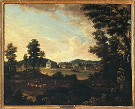
The former Kleudelburg hunting lodge (in the 18th century)
_Burgbergstollen-DSCF3388.jpg)


Sports
Economy and Infrastructure
Land use
In 2015, the municipal area covered a total of 5473 hectares, of which the following were accounted for in hectares :
| Type of use | 2011 | 2015 | |
|---|---|---|---|
| Building and open space | 269 | 272 | |
| from that | Living | 156 | 156 |
| Business | 35 | 35 | |
| Operating area | 14th | 14th | |
| from that | Mining land | 2 | 2 |
| Recreation area | 23 | 23 | |
| from that | Green area | 9 | 9 |
| traffic area | 408 | 408 | |
| Agricultural area | 1918 | 1914 | |
| from that | moor | 0 | 0 |
| pagan | 0 | 0 | |
| Forest area | 3732 | 3733 | |
| Water surface | 77 | 77 | |
| Other use | 32 | 32 | |
Economic structure
Battenberg has two business parks and an industrial area , which is home to the Hasenclever & Sohn ironworks, among others . The most important employers in the vicinity are the Viessmann factories in the neighboring community of Allendorf.
traffic

Battenberg is located near the intersection of the federal highways B 236 and B 253 , which connect the city with Frankenberg , Biedenkopf , Wetter and Hallenberg .
On the Bad Berleburg – Allendorf railway line opened in 1910, the Battenberg (Eder) station ( 51 ° 1 ′ 19.5 ″ N , 8 ° 38 ′ 18.8 ″ E ) was built below the town in the Edertal . In addition, the Auhammer industrial park to the north was developed with a stop ( 51 ° 1 ′ 55.8 ″ N , 8 ° 37 ′ 28.3 ″ E ). On the route there is still freight traffic between Battenberg and Frankenberg. In passenger transport, trips are only made to special events.
Long-distance cycle routes
The following cycle paths run in the vicinity of Battenberg :
- The Hessian long-distance cycle route R6 begins in Diemelstadt in northern Hesse and runs with a total length of 380 km to Lampertheim in southern Hesse.
- The Hessian long-distance cycle route R8 begins in Frankenberg and runs over 310 km through the Gladenbacher Bergland , the Westerwald , the Taunus , Frankfurt am Main and the Odenwald to the Bergstrasse .
- The 180 km long Ederauenradweg begins in the Rothaargebirge in North Rhine-Westphalia and is called Eder-Radweg in Hessen . It follows the course of the Eder to its confluence with the Fulda near Guxhagen .
- A cycle path along the Orange Route runs over 400 km from Bad Arolsen to Nassau . It connects cities that have been closely associated with the Dutch royal family for many centuries .
- The Lahn-Eder cycle path begins approx. 12 km north of Marburg in Sarnau and leads through the Wetschaft and Nemphe valleys and through the Burgwald to Frankenberg. It is particularly important as a connection between the Eder cycle path and the Lahntal cycle path .
Personalities
Sons and daughters
- Johann Antrecht (1544–1607), Chancellor of Hesse-Kassel
- Johannes Molther (1561–1618), Professor of Hebrew and Vice Rector of the Philipps University of Marburg
- Johann Jonas (von) Mylius (1652–1708), Hesse-Darmstadt prince educator and councilor
- Frank Wolff (* 1945), cellist
- Andreas Steinhöfel (* 1962), writer and translator
- Leonie Schwertmann (* 1994), volleyball player
People connected to the city
- Walter Frevert (1897–1962), headed the Battenberg Forestry Office from 1928 to 1936
- Lutz Klein (* 1943), 1975 to 1996 mayor of Battenberg, 2003 to 2009 district president of the administrative district of Kassel
See also
literature
- Magnus Backes (edit.): Dehio-Handbuch der Deutschen Kunstdenkmäler: Hessen. 2nd edition, Darmstadt 1982, ISBN 3-422-00380-0 , p. 66 f.
- Jens Friedhoff : Castles, palaces and aristocratic residences in the Hessian hinterland. Hinterländer Geschichtsverein (Ed.), 2018, p. 84.
- Erich Keyser : Hessian city book. Stuttgart 1957, pp. 57-59.
- Rudolf Knappe: Medieval castles in Hessen. 800 castles, castle ruins and fortifications. 3. Edition. Wartberg-Verlag, Gudensberg-Gleichen 2000, ISBN 3-86134-228-6 , p. 140 f., P. 149.
- Georg Wilhelm Sante (Hrsg.): Handbook of the historical sites of Germany . Volume 4: Hessen (= Kröner's pocket edition . Volume 274). 3rd, revised edition. Kröner, Stuttgart 1976, ISBN 3-520-27403-5 , p. 37 f.
- Magistrate of the city of Battenberg (Eder) (Hrsg.): 750 years of Battenberg (Eder). The mountain town in the forest. Verlag Wilhelm Bing, Korbach / Bad Wildungen 1984. (without ISBN)
- Matthias Seim (arrangement): Hessian City Atlas, Delivery IV, 4: Battenberg (Eder). Hessian State Office for Historical Regional Studies, Marburg 2015.
- Literature on Battenberg in the Hessian Bibliography
Web links
- Battenberg (Eder), Waldeck-Frankenberg district. Historical local dictionary for Hessen. In: Landesgeschichtliches Informationssystem Hessen (LAGIS).
- Battenberg (Eder), municipality, Waldeck-Frankenberg district. Historical local dictionary for Hessen. In: Landesgeschichtliches Informationssystem Hessen (LAGIS).
- Link catalog on the subject of Battenberg at curlie.org (formerly DMOZ )
Individual evidence
- ↑ Hessian State Statistical Office: Population status on December 31, 2019 (districts and urban districts as well as municipalities, population figures based on the 2011 census) ( help ).
- ↑ Ederknie nature reserve at Auhammer near Battenberg: One of the most natural river sections in Hesse. NABU Waldeck-Frankenberg, 2011, accessed on June 15, 2013 .
- ^ A b c Georg Wilhelm Justin Wagner : Statistical-topographical-historical description of the Grand Duchy of Hesse: Province of Upper Hesse . tape 3 . Carl Wilhelm Leske, Darmstadt August 1830, OCLC 312528126 , p. 17th f . ( Online at google books ).
- ↑ Incorporation of the Berghofen communities into the Battenberg community in the Frankenberg district on January 5, 1971 . In: The Hessian Minister of the Interior (Ed.): State Gazette for the State of Hesse. 1971 No. 3 , p. 110 , point 117 ( online at the information system of the Hessian state parliament [PDF; 5.5 MB ]).
- ^ Municipal reform: mergers and integration of municipalities from January 20, 1971 . In: The Hessian Minister of the Interior (ed.): State Gazette for the State of Hesse. 1971 No. 6 , p. 248 , item 328, para. 29 ( online at the information system of the Hessian State Parliament [PDF; 6.2 MB ]).
- ↑ Law on the reorganization of the districts of Frankenberg and Waldeck (GVBl. II 330-23) of October 4, 1973 . In: The Hessian Minister of the Interior (ed.): Law and Ordinance Gazette for the State of Hesse . 1973 No. 25 , p. 359 , § 13 ( online at the information system of the Hessian state parliament [PDF; 2,3 MB ]).
- ↑ a b Federal Statistical Office (ed.): Historical municipality register for the Federal Republic of Germany. Name, border and key number changes in municipalities, counties and administrative districts from May 27, 1970 to December 31, 1982 . W. Kohlhammer, Stuttgart / Mainz 1983, ISBN 3-17-003263-1 , p. 389, 390 and 415 .
- ↑ main statute. (DOCX; 26 kB) §; 5. In: Website. Municipality of Battenberg (Eder), accessed in March 2019 .
- ↑ Law on the reorganization of the districts of Frankenberg and Waldeck (GVBl. II 330-23) of October 4, 1973 . In: The Hessian Minister of the Interior (ed.): Law and Ordinance Gazette for the State of Hesse . 1973 No. 25 , p. 359 , § 13 ( online at the information system of the Hessian state parliament [PDF; 2,3 MB ]).
- ^ Federal Statistical Office (ed.): Historical municipality directory for the Federal Republic of Germany. Name, border and key number changes in municipalities, counties and administrative districts from May 27, 1970 to December 31, 1982 . W. Kohlhammer, Stuttgart / Mainz 1983, ISBN 3-17-003263-1 , p. 390 .
- ↑ Law on the reorganization of the Biedenkopf and Marburg districts and the city of Marburg (Lahn) (GVBl. II 330-27) of March 12, 1974 . In: The Hessian Minister of the Interior (ed.): Law and Ordinance Gazette for the State of Hesse . 1974 No. 9 , p. 154 , § 2 ( online at the information system of the Hessian state parliament [PDF; 3.0 MB ]).
- ↑ a b c d e f Battenberg (Eder), Waldeck-Frankenberg district. Historical local dictionary for Hessen. (As of January 30, 2020). In: Landesgeschichtliches Informationssystem Hessen (LAGIS).
- ^ Michael Rademacher: German administrative history from the unification of the empire in 1871 to the reunification in 1990. State of Hesse. (Online material for the dissertation, Osnabrück 2006).
- ^ Grand Ducal Central Office for State Statistics (ed.): Contributions to the statistics of the Grand Duchy of Hesse . tape 13 . G. Jonghause's Hofbuchhandlung, Darmstadt 1872, DNB 013163434 , OCLC 162730471 , p. 12 ff . ( Online at google books ).
- ↑ The affiliation of the Battenberg office based on maps from the Historical Atlas of Hessen : Hessen-Marburg 1567–1604 . , Hessen-Kassel and Hessen-Darmstadt 1604–1638 . and Hessen-Darmstadt 1567–1866 .
- ↑ a b Grand Ducal Central Office for State Statistics (ed.): Contributions to the statistics of the Grand Duchy of Hesse . tape 13 . G. Jonghause's Hofbuchhandlung, Darmstadt 1872, DNB 013163434 , OCLC 162730471 , p. 27 ff ., § 40 point 6e) ( online at google books ).
- ↑ a b Hessen-Darmstadt state and address calendar 1806 . In the publishing house of the Invaliden-Anstalt, Darmstadt 1806, p. 235 ( online in the HathiTrust digital library ).
- ^ A b Population according to nationality groups: Battenberg (Eder), city. In: Zensus2011. Bavarian State Office for Statistics , accessed in March 2020 .
- ^ Households by family: Battenberg (Eder), city. In: Zensus2011. Bavarian State Office for Statistics , accessed in March 2020 .
- ↑ Hessen-Darmstadt state and address calendar 1791 . In the publishing house of the Invaliden-Anstalt, Darmstadt 1791, p. 182 ( online in the HathiTrust digital library ).
- ↑ Hessen-Darmstadt state and address calendar 1800 . In the publishing house of the Invaliden-Anstalt, Darmstadt 1800, p. 194 ( online in the HathiTrust digital library ).
- ↑ Municipal data sheet : Battenberg (Eder). (PDF; 222 kB) In: Hessisches Gemeindelexikon. HA Hessen Agency GmbH
- ^ Local elections 1972; Relevant population of the municipalities on August 4, 1972 . In: The Hessian Minister of the Interior (ed.): State Gazette for the State of Hesse. 1972 No. 33 , p. 1424 , point 1025 ( online at the information system of the Hessian state parliament [PDF; 5.9 MB ]).
- ↑ a b Hessian Statistical Information System In: Statistics.Hessen.
- ^ Religious affiliation : Battenberg (Eder), city. In: Zensus2011. Bavarian State Office for Statistics , accessed in March 2020 .
- ^ Result of the municipal election on March 6, 2016. Hessian State Statistical Office, accessed in April 2016 .
- ^ Hessian State Statistical Office: Result of the municipal elections on March 27, 2011
- ^ Hessian State Statistical Office: Result of the municipal elections on March 26, 2006
- ↑ Mayoral election 2014
- ↑ town twinning. City of Battenberg, accessed June 15, 2013 .
-
^ Loon op Zand (Kaatsheuvel), Netherlands, since 1982

- ↑ Burgberg tunnel in Battenberg. City of Battenberg, accessed June 15, 2013 .

Allendorf (Eder) | Bad Arolsen | Bad Wildungen | Battenberg (Eder) | Bromskirchen | Burgwald | Diemelsee | Diemelstadt | Edertal | Frankenau | Frankenberg (Eder) | Gemünden (Wohra) | Haina (monastery) | Hatzfeld (Eder) | Korbach | Lichtenfels | Rosenthal | Twist valley | Vöhl | Volkmarsen | Waldeck | Willingen (Upland)