
Burgwald (municipality)
| coat of arms | Germany map | |
|---|---|---|

|
Coordinates: 51 ° 1 ′ N , 8 ° 46 ′ E |
|
| Basic data | ||
| State : | Hesse | |
| Administrative region : | kassel | |
| County : | Waldeck-Frankenberg | |
| Height : | 327 m above sea level NHN | |
| Area : | 41.29 km 2 | |
| Residents: | 4919 (Dec. 31, 2019) | |
| Population density : | 119 inhabitants per km 2 | |
| Postal code : | 35099 | |
| Primaries : | 06451, 06457 | |
| License plate : | KB, FKB, WA | |
| Community key : | 06 6 35 006 | |
| Community structure: | 5 districts | |
| Address of the municipal administration: |
Hauptstrasse 73 35099 Burgwald |
|
| Website : | ||
| Mayor : | Lothar Koch ( independent ) | |
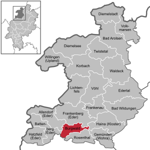
| Location of the municipality of Burgwald in the Waldeck-Frankenberg district | ||
  |
||

Burgwald is a municipality in the northern Hessian district of Waldeck-Frankenberg on the western edge of the eponymous Burgwald . The municipal administration is located in the district of the same name.
geography
Geographical location
Burgwald is located south of Frankenberg, east of Battenberg and about 30 km north of the university town of Marburg .
The community belongs to the area of the West Hessian mountain and depression country , on the northwestern edge of the castle forest . In the northwest, near Birkenbringhausen, the boundary extends into the Edertal .
The Eder forms the natural border to the municipality of Allendorf in the northwest . The Nemphe , which flows into the Eder at Frankenberg , runs through Bottendorf . The Senkelbach rises near Wiesenfeld and flows through Ernsthausen , where it flows into the Wetschaft . The Rhine-Weser watershed runs through the municipality , so that the Eder and its tributaries flow into the Fulda and Weser , the Wetschaft and its tributaries into the Lahn and the Rhine .
The lowest point in the parish is 285 m above sea level. NN in the Ederaue, at the Hatzbachmühle. The highest point is a mountain with a height of 433.5 m above sea level. NN , southwest of the Bödde-Berg ( 410 m above sea level ). Both mountains are located in the easternmost area of the municipality marker between the villages of Oberholzhausen (zu Haina ) and Willersdorf (zu Frankenberg ).
With a 50 percent forest share in the municipality, Burgwald is one of the most densely forested municipalities in Hesse.
Neighboring communities
Burgwald borders the city of Frankenberg to the north, the municipality of Haina to the east, the city of Rosenthal (all in the Waldeck-Frankenberg district) to the south, the Münchhausen municipality to the southwest ( Marburg-Biedenkopf district ) and the city to the west Battenberg and the community of Allendorf (both in the Waldeck-Frankenberg district).

Community structure
The community is divided into the following districts (first documented mention in brackets):
- Burgwald in the northern center (1948 as Industriehof)
- Bottendorf in the northeast (1233)
- Ernsthausen in the south (1303)
- Birkenbringhausen in the northwest (1249)
- Wiesenfeld in the southern center (1238)
climate
In the area of the municipality, the warm, temperate rainy climate of mid-latitudes in Europe that is typical of Hessen is evident. The wind blows mainly from the west and brings humid air masses from the Atlantic all year round, which results in precipitation. Due to the location in the rain shadow east of the Rothaargebirge , the rainfall is low. The oceanic influence ensures relatively mild winters and not too hot summers.
The daily mean temperature in the years 1971–2000 ranged from +7 ° C to +9 ° C. A warming can be observed.
The amount of precipitation in the years 1971–2000 was between 600 and 800 mm.
The hours of sunshine in the years 1971–2000 averaged between 1,400 and 1,450 hours.
history
local community

While the districts of Birkenbringhausen, Bottendorf, Ernsthausen and Wiesenfeld go back to medieval foundations, the district of Burgwald emerged as a post-war settlement on the site of a former ammunition plant (Muna) . It was called Industriehof until it was renamed in 1996 .
Territorial reform
As part of the regional reform in Hesse , the municipalities of Birkenbringhausen, Ernsthausen and Wiesenfeld voluntarily merged to form a municipality called Burgwald on July 1, 1971 . On January 1, 1974, the previously independent community of Bottendorf was added by virtue of state law. Local districts with local advisory councils and local councilors were formed for all formerly independent communities .
politics
Community representation
The local elections on March 6, 2016 produced the following results, compared to previous local elections:
| Parties and constituencies |
% 2016 |
Seats 2016 |
% 2011 |
Seats 2011 |
% 2006 |
Seats 2006 |
% 2001 |
Seats 2001 |
||
|---|---|---|---|---|---|---|---|---|---|---|
| SPD | Social Democratic Party of Germany | 17.1 | 4th | 21.1 | 5 | 24.0 | 6th | 31.4 | 10 | |
| WGBo | Voting community Bottendorf | 19.9 | 4th | 19.0 | 4th | 13.4 | 4th | 11.8 | 4th | |
| FWG | Free voter community Birkenbringhausen | 17.9 | 4th | 17.2 | 4th | 17.2 | 5 | 15.5 | 5 | |
| BLE | Ernsthausen citizens' list | 20.2 | 5 | 17.2 | 4th | 21.3 | 6th | 17.4 | 5 | |
| CDU | Christian Democratic Union of Germany | 12.5 | 3 | 12.6 | 3 | 12.7 | 3 | 17.0 | 5 | |
| SU | Burgwald Citizens List | 9.2 | 2 | 10.6 | 2 | 10.9 | 3 | 6.8 | 2 | |
| FDP | Free Democratic Party | 3.1 | 1 | 2.4 | 1 | - | - | - | - | |
| GREEN | Alliance 90 / The Greens | - | - | - | - | 0.6 | 0 | - | - | |
| total | 100.0 | 23 | 100.0 | 23 | 100.0 | 27 | 100.0 | 31 | ||
| Voter turnout in% | 54.0 | 57.0 | 55.4 | 60.3 | ||||||
mayor
- Walter Hollmann, temporarily appointed as State Commissioner
- - February 1991 Fritz Thiele
- March 1991 - April 2009 Adam Daume (SPD)
- May 2009 - today: Lothar Koch (independent)
coat of arms
"The coat of arms shows under a blue crenellated shield head to seven pinnacles in the shield divided by silver and green in the pine cut to four points with two branches each below a silver Johanniterkreuz ".
Coat of arms declaration: “The coat of arms contains the colors blue, green and silver. Blue for the sky, silver for the battlements of a castle as well as the Johanniterkreuz and green for the treetops. The castle battlements point to the Kesterburg (today Christenberg ) in the castle forest. A bright blue sky arches over the castle battlements. The pointed tops of fir and spruce trees are depicted under the battlements. They are kept in lush green. Another part of the castle forest coat of arms is the Johanniterkreuz. This four-pointed cross with arrowheads pointing inwards indicates the history of the Wiesenfeld district. In 1238 the village was created as a Johanniter - Kommende . "
Partnerships
The municipality has a partnership with Perbál in Hungary not far from the capital Budapest .
Culture and sights
Hans Ross memorial
In Pfuhlgrund, east of the village, on the edge of the Burgwald there is a monument to the Ernsthäuser forester Hans Ross. He was killed in pursuit of poachers in 1676.
Local dialects
Local dialects have developed over the centuries in the towns of Birkenbringhausen, Bottendorf, Ernsthausen and Wiesenfeld . In contrast, the district of Burgwald was not settled until after the Second World War, so that no dialect of its own was created here. The inhabitants themselves call their language Platt (birch Bringhäuser Platt, Platt Bottendorfer etc.), not to be confused with the spoken in Northern Germany Low German . Without there being any reliable figures, the number of residents who speak the respective dialect has probably fallen massively in recent years.
Ortsnecknames
The Birkenbringhäuser are called "Ratzverbrenner", the Bottendorfer "Waschtemailer" and the Ernsthäuser "Brüchhinkel". Background information on these local names can be found on the pages of the respective districts.
Sports
For years, are Prellballer TSV Ernsthausen, the artistic cycling of RSV Ernsthausen and the shooters of SV Ernsthausen nationally successful.
societies
Around 50 clubs and associations are active in the community, some of which are community-wide.
NABU Burgwald
The Burgwald environmental group was founded on September 10, 1991. In the following year she joined the Naturschutzbund Deutschland (NABU, formerly the German Federation for Bird Protection). The association currently has around 60 members. The main focus of the work is biotope and landscape maintenance and the associated protection and restoration of the ancestral flora and fauna in the north-western region of the castle forest. Today the work in the biotope network system "Upper Wetschafttal " between Ernsthausen and Roda is very broad .
Economy and Infrastructure

traffic
The federal road 252 , which connects Marburg and Korbach , runs through the community from Ernsthausen to Bottendorf .
The district road 117 runs past the districts of Burgwald and Wiesenfeld between Ernsthausen and Frankenberg. The district road 118 leads from Wiesenfeld to Birkenbringhausen, the district road 124 from Birkenbringhausen to Burgwald.
Birkenbringhausen, Wiesenfeld and Ernsthausen are stops on the Burgwald Railway from Frankenberg to Marburg. The stations in Burgwald belong to the tariff area of the North Hessian Transport Association (NVV) . Burgwald does not have its own train station. The residents use the Birkenbringhausen train station halfway between Birkenbringhausen and Burgwald. It is a stop of the Burgwaldbahn , on which rail buses of the type VT 628 run regularly .
Several signposted long-distance cycle routes lead across the municipality or directly past it. To the west of Birkenbringhausen go the Hessian long-distance cycle route R8 and the Ederauenradweg , which runs along the Eder from the source in the Rothaargebirge to the confluence with the Fulda. To the east of Bottendorf, the Hessian long-distance cycle route R6 leads through the castle forest . The Lahn-Eder cycle path , which leads from Marburg to Frankenberg, reaches the former district town of Frankenberg when coming from Ernsthausen in the south via the Bottendorf area.
Public facilities
Each of the five districts has a village community center that is used by associations and for private events.
education
In Bottendorf and Ernsthausen, children up to the fourth grade are taught in primary schools . They each offer support at primary schools and a speech therapy clinic.
Children are looked after in the kindergartens in the districts of Birkenbringhausen, Bottendorf, Burgwald and Ernsthausen.
Companies
- Finger Holzbau GmbH, prefabricated houses
- Kahl and Schlichterle, beverage machines
- OSBORN International GmbH, manufacturer of technical brushes and tools for surface treatment
- Gaydos, seating
- Heitec, mechanical engineering (hot runner technology)
- Herko Chemie Hermann Kohlmann
- Metak, plastics processing and mold making
- Schlesinger, mechanical engineering (including machines for making brushes) and brooms
- Thuasne Germany, elastic textile fabrics in the medical and sports sector (orthopedic aids, elastic compression materials)
- Ropal AG, special coating (chrome)
Personalities
- Balthasar von Dernbach (1548–1606), born in Wiesenfeld, prince abbot of Fulda 1570–1606.
- Johannes Engel (1894–1973), born in Ernsthausen, politician ( NSDAP ) and from 1933 to 1945 member of the National Socialist Reichstag.
literature
- Ulrich Stöhr, Reinhold Briel, Johannes Briel: Ernsthausen 1303-2003. Chronicle for the 700th anniversary. Edited by the community of Burgwald. Burgwald-Ernsthausen 2003
- Literature about Burgwald in the Hessian Bibliography
Web links
- Website of the municipality of Burgwald
- Burgwald, Waldeck-Frankenberg district. Historical local dictionary for Hessen. In: Landesgeschichtliches Informationssystem Hessen (LAGIS).
- Link catalog on Burgwald at curlie.org (formerly DMOZ )
References and comments
- ↑ Hessian State Statistical Office: Population status on December 31, 2019 (districts and urban districts as well as municipalities, population figures based on the 2011 census) ( help ).
- ↑ Daily mean temperature year 1971–2000. In: Environmental Atlas Hessen. Hessian State Office for Environment and Geology, 2006, accessed November 2018 .
- ↑ Amount of precipitation in 1971–2000. (No longer available online.) In: Umweltatlas Hessen. Hessian State Office for Environment and Geology, 2006, archived from the original on March 6, 2006 ; Retrieved June 4, 2008 . Info: The archive link was inserted automatically and has not yet been checked. Please check the original and archive link according to the instructions and then remove this notice.
- ↑ Duration of sunshine from 1971–2000. (No longer available online.) In: Umweltatlas Hessen. Hessian State Office for Environment and Geology, 2006, archived from the original on March 2, 2006 ; Retrieved June 4, 2008 . Info: The archive link was inserted automatically and has not yet been checked. Please check the original and archive link according to the instructions and then remove this notice.
- ^ Municipal reform in Hesse: mergers and integrations of municipalities from June 21, 1971 . In: The Hessian Minister of the Interior (ed.): State Gazette for the State of Hesse. 1971 No. 28 , p. 1117 , item 988; Para. 7. ( Online at the information system of the Hessian State Parliament [PDF; 5.0 MB ]).
- ↑ Law on the reorganization of the districts of Frankenberg and Waldeck (GVBl. II 330-23) of October 4, 1973 . In: The Hessian Minister of the Interior (ed.): Law and Ordinance Gazette for the State of Hesse . 1973 No. 25 , p. 359 , § 10 ( online at the information system of the Hessian state parliament [PDF; 2,3 MB ]).
- ^ Federal Statistical Office (ed.): Historical municipality directory for the Federal Republic of Germany. Name, border and key number changes in municipalities, counties and administrative districts from May 27, 1970 to December 31, 1982 . W. Kohlhammer, Stuttgart / Mainz 1983, ISBN 3-17-003263-1 , p. 390 .
- ↑ Local law. In: website. Burgwald municipality, accessed February 2019 .
- ^ Result of the municipal election on March 6, 2016. Hessian State Statistical Office, accessed in April 2016 .
- ^ Hessian State Statistical Office: Result of the municipal elections on March 27, 2011
- ^ Hessian State Statistical Office: Result of the municipal elections on March 26, 2006
- ^ Burgwald: Adam Daume appoints Lothar Koch as the new mayor. Waldeckische Landeszeitung / Frankenberger Zeitung, accessed on May 1, 2009 .
- ↑ Mayor election on November 30, 2008: Burgwald (Waldeck-Frankenberg district). (No longer available online.) Hessischer Rundfunk, November 30, 2008, formerly in the original ; Retrieved November 30, 2008 . ( Page no longer available , search in web archives ) Info: The link was automatically marked as defective. Please check the link according to the instructions and then remove this notice.
- ↑ parish council of the municipality Burgwald: Mail to User: Maseltov . April 6, 2006.
- ↑ Ulrich Stöhr, Reinhold Briel, Johannes Briel: Ernsthausen 1303-2003 . Burgwald community, Burgwald 2003, p. 171-176 .
- ↑ The spelling used here reflects the names in the Ernsthausen dialect.
- ↑ Wolfgang Tripp: Chronicle. TSV Ernsthausen, May 22, 2008, accessed on July 4, 2008 .
- ^ Schützenverein Ernsthausen writes history
- ↑ nabu-burgwald.de
- ↑ Bottendorf primary school. In: Hessian education server. Office for Teacher Education (AfL), December 9, 2006, accessed July 3, 2008 .
- ^ Ernsthausen primary school. In: Hessian education server. Office for Teacher Education (AfL), December 9, 2006, accessed July 3, 2008 .

Allendorf (Eder) | Bad Arolsen | Bad Wildungen | Battenberg (Eder) | Bromskirchen | Burgwald | Diemelsee | Diemelstadt | Edertal | Frankenau | Frankenberg (Eder) | Gemünden (Wohra) | Haina (monastery) | Hatzfeld (Eder) | Korbach | Lichtenfels | Rosenthal | Twist valley | Vöhl | Volkmarsen | Waldeck | Willingen (Upland)