Wetschaft
| Wetschaft | ||
|
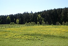
Wet meadows at the Wetschaft in the biotope network system Upper Wetschafttal near Roda |
||
| Data | ||
| Water code | DE : 25818 | |
| location |
West Hessian mountain and valley land
|
|
| River system | Rhine | |
| Drain over | Lahn → Rhine → North Sea | |
| source | southeast of Roda 50 ° 57 ′ 41 " N , 8 ° 47 ′ 47" E |
|
| Source height | approx. 360 m above sea level NN | |
| muzzle | near Lahntal- Göttingen in the Lahn coordinates: 50 ° 52 '8 " N , 8 ° 46' 54" E 50 ° 52 '8 " N , 8 ° 46' 54" E |
|
| Mouth height | approx. 192 m above sea level NN | |
| Height difference | approx. 168 m | |
| Bottom slope | approx. 5.8 ‰ | |
| length | 29 km | |
| Catchment area | 196.204 km² | |
| Drain |
MQ |
1,701.6 m³ / s |
The Wetschaft is a 29 km long orographically left tributary of the Lahn in the Hessian districts of Waldeck-Frankenberg and Marburg-Biedenkopf ( Germany ).
geography
course
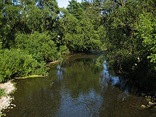
The Wetschaft rises in the castle forest on the southeast flank of the Wasserberg , about 2 km southeast of Roda . Your source, the Landgrafenborn , lies at an altitude of 360 m above sea level. NN . Flowing from its source to the southeast, the Wetschaft turns after a short run to the west and a few kilometers further north. After Roda has flown through, the river turns in a wide arc to the south.
From Ernsthausen flowing in a southerly direction, the river still passes its western boundary and Münchhausen , Simtshausen and Todenhausen .
After the tributary Treisbach, by far the most abundant in water, flows in from the right or west, the Wetschaft, which has more than doubled its amount of water as a result, still has weather and low weather , to the southeast of Lahntal - Göttingen at 192 m above sea level. NN to flow into the Lahn on the left .
On its 29 km long path, the Wetschaft overcomes a difference in altitude of 168 m, which corresponds to an average bed gradient of 5.8 ‰. In doing so, it drains a catchment area of 196.204 km² over the Lahn and Rhine to the North Sea .
Tributaries
The tributaries from the headwaters to the confluence with the Lahn are listed below. The inflow side, the length of the watercourse, its catchment area and, if known, its mean discharge are listed in brackets.
- Schafterbach ( right ; 2.6 km, 2.2 km²)
- Senkelbach ( right ; 5.5 km, 5.5 km²)
- Langer Grund ( right to the Senkelbach ; 1.6 km, 3.1 km²)
-
Wollmar ( right ; 9.6 km, 27.6 km², 278 l / s)
- Bach vom Lichternberg, ( left to Wollmar ; 3.4 km)
- Langengrund (right to Wollmar ; 2.1 km)
- Silberbornbach ( Hutschbach ) ( left ; 2.7 km, 4.8 km²)
- Brook from Obersimtshausen-West ( right ; 1.1 km, 1.8 km²)
- Bach vom Christenberg ( Bach von Obersimtshausen-Ost ) ( left ; 5.9 km, 6.8 km²)
- Treisbach ( right , 17.2 km, 68.2 km², 810 l / s)
- Mellnau ( left ; 7.3 km; 8.8 km²)
-
Rosphe ( left ; 8.2 km, 18.6 km², 76 l / s)
- Rosphequelle ( right to Rosphe ; 1.4 km)
- Bach vom Bachtenberg ( right to Rosphe ; 3.9 km)
Main river
Although the Treisbach is somewhat shorter at the confluence with the Wetschaft (17.2 km compared to approx. 20 km) and has a slightly smaller catchment area (68.2 vs. 87.4 km²), its discharge is 810 l / s higher than the wetschaft (666 l / s) at this point in time. Therefore, the estuary can be seen as an equal confluence of the two main arms, whose catchment areas also differ significantly in terms of natural space ; The Wetschaft primarily drains the Burgwald , which is part of the West Hessian Uplands , the Treisbach the bagpipe, which is assigned to the Southern Uplands , together with foreheads .
The two rivers Treisbach (with Asphe ) and Wollmar take up only 49% of the catchment area of the Wetschaft, but with a total of 1088 l / s they carry 64% of the total water. This is u. a. owed to the fact that they arise in a higher region (up to 674 m compared to 400 m).
environment
Up to the confluence of the Treisbach, the Wetschaft is one of the fine-material, silicate low mountain streams ( water type 5.1), below it as a silicate low mountain river (water type 9).

In the upper section between Roda and Ernsthausen, the “Upper Wetschafttal” biotope network was set up. Extensive maintenance of wet meadows and the creation of new biotopes (for example, by creating new ponds by blasting them, grazing with water buffalo or restoring moors ) are intended to restore the habitat typical of the site to the flora and fauna that have been pushed back in the past centuries by intensive agricultural use .
The Burgwaldbahn Marburg-Frankenberg, the federal road 252 and the Lahn-Eder cycle path run through the valley .
Individual evidence
- ↑ a b c Topographic map 1: 25,000
- ↑ a b c Water map service of the Hessian Ministry for the Environment, Climate Protection, Agriculture and Consumer Protection ( information )
- ↑ Karl-Hermann Völker: Explosives create a new biotope - THW Marburg organized a large-scale exercise for nature conservation purposes at Roda (web archive). NABU Burgwald, accessed on May 27, 2016 .
- ^ Karl-Hermann Völker: "Biobagger" in the marsh grass. A landscape conservation project of the nature conservation association with water buffalo began in Henzeried. NABU Burgwald, accessed on July 28, 2016 .
- ^ Karl-Hermann Völker: A moor with Heidschnucken. The "lateral break" near Ernsthausen was declared a natural monument. NABU Burgwald, accessed on July 28, 2016 .
Web links
- Retention cadastre river area Wetschaft river area code number: 25818 (PDF file; 915 kB)


