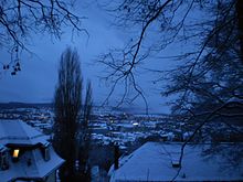
Marburg-Giessen Lahntal
The Marburg-Gießener Lahntal is the natural spatial main unit 348 of the main unit group 34 - West Hessian mountains . It includes the Lahn valley from north of Cölbe to west of Solms and thus in particular the agglomeration of the central Hessian regional centers of Marburg , Gießen and Wetzlar .
The main unit comprises the mouth of various Lahn tributaries and is divided into the Marburger Bergland , which also includes the red sandstone ridges of the Marburger Ridge and Lahnberge , which are up to 380 m above sea level and towering over the floodplain by around 200 m , and the Giessen basin with the congestion areas the cities of Gießen and Wetzlar, which flows into the Wetterau to the south (east) .
The Giessen basin is part of the Mediterranean-Mjösen zone , a series of valley basins that stretch from the Rhone Valley over the Upper Rhine Graben , the Wetterau and the Giessen basin, below the Vorderen Vogelsberg, and finally to the Amöneburg basin , from there over the Neustädter Sattel into the West Hessian region Lower and continue over the Leinegraben to the Oslograben .
Location and limits
The Lahn, whose source is in the Rothaargebirge and whose further upper course runs over the Obere Lahn valley and the south of the Wetschaft-Senke , takes its middle course in the Marburg and then in the Giessener Lahntalsenke . The lower reaches the Gießen-Koblenzer Lahntal , which extends the Moselle valley on the left bank of the Rhine across the Middle Rhine region .
To the right of the Lahn lie parts of the Gladenbacher Bergland (partly separated from the Marburg Ridge ), to the left of the river various parts of the West Hessian Bergland , below the Lahnberge in particular the Vordere Vogelsberg , and finally the Eastern Hintertaunus .
Natural structure
- 348 Marburg-Giessener Lahntal
- 348.0 Marburg highlands
- 348.00 Marburg back
- 348.01 Lahnberge
- 348.02 Marburg Lahntalsenke
- 348.1 Giessen Basin
- 348.10 Giessen Lahntalsenke
- 348.11 Grossenlinden hill country
- 348.0 Marburg highlands
Places and tributaries
The following municipalities lie downstream in the Marburg-Gießener Lahntal or the following tributaries flow into the Lahn (river names in italics, tributary side or location in brackets).
( Note: "right" means "west" up to Gießen, so left on a north-facing map! ):
- Ohm (59.7 km, left)
- Cölbe
- Marburg with Marburg back (r) and Lahnbergen (l)
- Weimar
- Allna (19.1 km, r)
- Wenkbach
- Fronhausen
- Zwester Ohm (20.0 km, l)
- Salzböde (27.6 km, r)
- Lollar
- Lumda (30.0 km, l)
- Wettenberg (r)
- Wißmarbach (6.2 km, r)
- Gleibach (r)
- to water
- Wieseck (24.3 km, l)
- Fohnbach (12.0 km, r)
- Bieber (13.6 km, r)
- Heuchelheim (r)
- Kleebach (l)
- Welschbach (l)
- Lahnau (r)
- Schwalbenbach , partly also Atzbach (9.5 km, right)
- Wetzlar
- Dill (55.0 km, r)
- Solms
- Grundbach (r)
- Solmsbach (l)
Surrounding mountain ranges
Left the Lahn
The Burgwald only touches the Marburg-Gießener Lahntal in the extreme north. Below the tributary of the Ohm , the Lahnberge continue its red sandstone ridge to the south, which ends with the tributary of the Zwester Ohm near Fronhausen . From then on, the basalt high plateau of the Vorderen Vogelsberg accompanies the Lahn east to Gießen . After a short break through the southern foothills of the shallower Giessen basin, the Hintertaunus closes on the left, i. H. now south of the Lahn.
On the right the Lahn
The Marburg Ridge to the west follows the Lahn valley to Niederweimar and is replaced by the temperate flat land of the eastern Salzbödetal (part of the Gladenbacher Bergland ), from around Fronhausen the Krofdorf-Königsberger Forst (also Gladenbacher Bergland) accompanies the Lahn west and later to the north until it is behind the Dilltal is replaced by the eastern foothills of the Dillwesterwald .
landscape
In the area of the city of Marburg, due to the ridges to the left and right of the Lahn, the Lahnaue is only one, a maximum of 2 km wide and densely populated, but widens significantly when the Marburg Ridge subsides. In this area, the valley is also heavily used for agriculture.
From around Lollar , the Lahnaue represents an urban agglomeration. The southern Gießen basin, the so-called Großlindener Hügelland, which marks the transition to the Wetterau , is mainly used for agriculture , whereby the separation of these flat landscapes is largely made by the Lahn- Main watershed.
Individual evidence
- ^ Geological overview map of Hesse. Historical atlas of Hessen. In: Landesgeschichtliches Informationssystem Hessen (LAGIS).
swell
- Federal Agency for Nature Conservation
- Map services ("Protected areas" map service makes the boundaries of the main units selectable)
- Environmental Atlas Hesse
- map
- Description (main unit 348)
Web links
- Aerial photo of the Marburg-Gießener Lahntal / kmz download ( Google Earth required!)


