Wieseck (river)
| Wieseck | ||
|
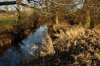
The Wieseck near Gießen- Wieseck |
||
| Data | ||
| Water code | DE : 25838 | |
| location |
West Hessian mountain and valley land
|
|
| River system | Rhine | |
| Drain over | Lahn → Rhine → North Sea | |
| source | End of the kilometer on the Lumda plateau near Göbelnrod 50 ° 36 ′ 27 ″ N , 8 ° 55 ′ 50 ″ E |
|
| Source height | approx. 295 m above sea level NHN Wieseckquelle near Saasen |
|
| muzzle | in Gießen in the Lahn coordinates: 50 ° 35 ′ 0 ″ N , 8 ° 39 ′ 40 ″ E 50 ° 35 ′ 0 ″ N , 8 ° 39 ′ 40 ″ E |
|
| Mouth height | approx. 155 m above sea level NHN | |
| Height difference | approx. 140 m | |
| Bottom slope | approx. 5.8 ‰ | |
| length | 24.3 km | |
| Catchment area | 119.719 km² | |
| Drain |
MNQ MQ |
145 l / s 664 l / s |
| Medium-sized cities | to water | |
| Small towns | Grünberg (Hesse) | |
| Communities | Reiskirchen , Buseck | |
The Wieseck is a 24.3 km long, eastern and orographically left tributary of the Lahn in the Vorderen Vogelsberg , which flows in the Hessian district of Gießen . Giessen's largest district - Wieseck - is named after her .
geography
course
The Wieseck rises in the south of the natural area Lumda-Plateau . Its source , the contained Wieseck spring , is located on the northern edge of Saasen - north of the residential street Winneröder Strasse at about 235 m above sea level. NHN . The kilometering of the flowing water ends in the urban area of Grünberg 1.3 km north-northeast of Göbelnrod and 1.3 km south-southwest of the Grünberg district of Beltershain - about 650 m north of the summit of the Hoheberg ( 304.5 m ) - at an altitude of around 295 m .
The Wieseck flows mainly in a westerly direction. Initially it runs south to Göbelnrod, from where it flows westwards through Saasen and Reiskirchen . Then it changes over to the Laubach hill country , into which it takes up the Flachsbach, only to flow into the Giessener Lahntalsenke shortly afterwards . It runs through Großen-Buseck and Trohe , before passing through the Giessen district of Wieseck .
Immediately afterwards, the Wieseck reaches the Gießen core city, where, after flowing around the city center to the south - a little north-northeast above the Gießen train station - at about 155 m above sea level it flows into the Lahn , a tributary of the Rhine coming from the north .
Natural allocation
The Wieseck runs in the natural spatial main unit group West Hessisches Bergland (No. 34) and (viewed downstream) in the main unit Vorderer Vogelsberg (349) through the subunits Lumda-Plateau (349.0) and Laubacher Hügelland (349.3) and, in the main unit Marburg-Gießener Lahntal (348) and in the subunit Gießen Basin (348.1) through the natural area of Gießen Lahntalsenke (348.10). The river valley forms roughly the southern border of the Lumda plateau , by far the largest mountain range in the Vorderen Vogelsberg .
Water quality
The saprobic index of the Wieseck is 1.77 in the middle course (near Großen-Buseck ), which corresponds to a "good" status according to the specifications of the WFD . In the lower reaches within the urban area this is 2.34, which corresponds to a "moderate" condition. The structural condition, however, is to be rated as "bad". The assessment using the structural quality mapping method shows the Wieseck to be severely impaired in large areas. Almost 96% of the sections were rated "significantly changed" or worse, only about 4% were rated "moderately changed" or better, which would correspond to the target. Various other indices, which are calculated by evaluating the settlement of the Wieseck with aquatic organisms ( macrozoobenthos ), confirm this poor condition. These structural impairment of the water body values assign the Wieseck in the middle course near Grossen-Buseck an "unsatisfactory" condition, in the lower course in the urban area of Gießen a "bad" condition. According to the WFD, which calls for "good ecological status" by 2015, there is a need for action to improve this status, which is to be done in the next few years.
leisure
The Wieseckaue between Großen-Buseck and Gießen serves as an excursion destination, and to the northeast of the city center of Gießen is the Wieseckaue City Park. The glider airfield of the Flugsportverein Gießen is located in the meadow landscape. The Lumda and Wieseck valleys can be accessed through the Lumda-Wieseck cycle path .
Individual evidence
- ↑ a b Map services of the Federal Agency for Nature Conservation ( information )
- ↑ a b The Wieseckquelle (p. 5) and The Wieseckquelle (p. 6; continuation ), in Heimatbrief 1/1999 and 2/1999 , Heimatgeschichtliche Vereinigung Reiskirchen e. V., accessed on October 17, 2016, at hgv-reiskirchen.de (PDF; 1.11 and 1.15 MB)
- ↑ Topographic map 1: 25,000
- ↑ a b c Water map service of the Hessian Ministry for the Environment, Climate Protection, Agriculture and Consumer Protection ( information )
- ^ Gerhard Sandner: Geographical land survey: The natural space units on sheet 125 Marburg. Federal Institute for Regional Studies, Bad Godesberg 1960. → Online map (PDF; 4.9 MB)
- ^ GESIS Hessen
Web links
- Retention cadastre, river area Wieseck river area code number: 25838 (PDF file; 4.22 MB)
- Water profile and program of measures 25838.1 ( Memento from January 1, 2013 in the web archive archive.today ) ( Notes ) → Overview of all Hessian river systems (PDF, 1.7 MB) Wieseck
