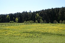
Lahn-Eder cycle path
| Lahn-Eder cycle path | |
|---|---|

|
|
| overall length | 29 km |
| location | Burgwald , Lahn , Eder / Hessen |
| map | |
| Link to map and elevation profile | |
| Starting point | Lahn valley ( Bf ) |
| Target point | Frankenberg an der Eder ( Bf ) |
| Places along the way | Wetter ( Bf ), Münchhausen ( Bf ), Burgwald ( Bf ) |
| Flooring | approx. 92% asphalt |
| Height difference | approx. 200 m to approx. 350 m / approx. 276 m ascent / approx. 171 m of descent |
| difficulty | medium (up to 4%) |
| Traffic volume | low |
| Connection to | Lahntal-Radweg , Eder-Radweg , Hessische Fernradwege R2 , R6 |
| Website URL | www.marburg-tourismus.de |
The Lahn-Eder cycle path starts in Lahntal- Sarnau , about twelve kilometers north of Marburg , on the Lahn and leads through the Wetschaft valley and along the western edge of the northern castle forest to Frankenberg an der Eder . The path is especially important as a connection between the long -distance cycle paths Eder cycle path and Lahntal cycle path .
Route profile
- Length: 29 kilometers (Lahntal-Goßfelden-Frankenberg (Eder))
- Signs: available in both directions.
- Gradients: from the Lahn up to Wiesenfeld , about 190 meters in altitude must be overcome, usually over smaller gradients; a somewhat longer slope has to be overcome between Wiesenfeld and the Birkenbringhausen train station below Burgwald , or in the opposite direction from the Eder bridge near Röddenau up to the train station
- Path condition: partly asphalt paths and concrete paths (especially between Goßfelden and Ernsthausen), partly split field and forest paths (mainly between Ernsthausen and Frankenberg), gravel on shorter stretches
- Traffic congestion: outside the villages, the route leads over back roads and paved field and forest paths
- Suitable bike: touring bike with gearshift suitable for mountains, the route is unsuitable for racing bikes with narrow tires
- Suitable for families: for a long part of the route, the path is flat with small inclines and is therefore well suited to partial routes with smaller children; if the condition is not sufficient, you can use the train (see below)
- Inline suitability: only suitable on the paved routes, otherwise unsuitable
Transport links
Public transportation
- with the upper Lahntalbahn to Lahntal-Sarnau, or with the Burgwaldbahn to Frankenberg; With the reopening of the railway line from Frankenberg (Eder) to Korbach, it is possible to continue towards the Kellerwald-Edersee National Park, to Warburg and towards Kassel .
- the Marburg-Frankenberg railway runs parallel to the bike path for a long time; Railway stations can be found in Sarnau, Wetter (Hessen), Simtshausen, Münchhausen, Ernsthausen (Frankenberg district), Wiesenfeld and Birkenbringhausen
- The next supraregional train station is Marburg with stops for ICs as well as regional express and regional trains
- Bicycles can be taken on the local trains of the transport associations RMV and NVV without registration
Connection to long-distance cycle paths

Lahn-Eder cycle path at the elementary school in Burgwald -Ernsthausen
- Mittelland-Route (D4) / Hessischer Radfernweg R2 / Lahntal-Radweg in Lahntal-Sarnau with a short journey to Cölbe to the German Unity Cycle Route
- Ederauenradweg / Oranier-Route / GeoRadroute Ruhr-Eder in Frankenberg (route Rödenau-Frankenberg identical)
- Hessian long-distance cycle route R6 in Frankenberg
On the way there are connections to other regional cycle paths such as the Burgwald cycle path , Otto Ubbelode cycle path and the Treisbachtal cycle path, some of which run on the same paths.
Route description with sights
Corner points of the route
- Lahntal-Sarnau
- Wetter (Hessen) - Detour to Mellnau with its castle ruins
- Todenhausen - former Huguenot settlement
- Simtshausen
- Münchhausen - Detour to the Christenberg: the Martinskirche was builton the area with originally Celtic and Franconian fortifications, in the former sexton's house excavated finds and models of the fortifications are shown as part of a permanent exhibition, there is also an excursion restaurant (here you can get the key for the sexton's house and the church) with a wonderful view of the Burgwald and the Rothaargebirge, barrows were found in the western area of the summit
- Ernsthausen - - Biotope network system Upper Wetschafttal between Ernsthausen and Roda
- Wiesenfeld - Johanniter and Huguenot community
- Birch Bringhausen
- Burgwald
- Frankenberg (Eder)

10-tower town hall in Frankenberg
References to literature and maps
- General German Bicycle Club (2007): Bicycle tour map. Official card of the General German Bicycle Club eV; up-to-date map, all content newly researched; Long-distance cycle paths, train, bed + bike. Part: 16., Rhine, Main, North Hesse. 8th edition, completely revised. New edition with new digital cartography Bielefeld: BVA, ISBN 978-3-87073-372-8
- Cycling and hiking map Burgwald, Kellerwald. Marburg, Kirchhain, Stadtallendorf, Neustadt, Schwalmstadt, Gemünden, Wetter, Rosenthal, Frankenberg, Frankenau, Waldeck, Bad Wildungen, Bad Zwesten, Medebach. New castle forest path with extra tours; Kellerwaldsteig with access roads; Nordic walking routes. (2007): New edition. Nordhausen: Kartographische Kommunale Verlags-Gesellschaft, ISBN 978-3-937929-79-8
Web links
Commons : Lahn-Eder-Radweg - Collection of pictures, videos and audio files
Wikivoyage: Lahn-Eder Cycle Route - travel guide
- Lahn-Eder-Radweg In: Radroutenplaner Hessen
- Lahn-Eder-Radweg In: www.marburg-tourismus.de
- Lahn-Eder cycle path at openstreetmap
Coordinates: 50 ° 52 ′ 13.1 " N , 8 ° 45 ′ 26.3" E


