Twist valley
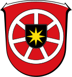
| coat of arms | Germany map | |
|---|---|---|

|
Coordinates: 51 ° 20 ′ N , 8 ° 57 ′ E |
|
| Basic data | ||
| State : | Hesse | |
| Administrative region : | kassel | |
| County : | Waldeck-Frankenberg | |
| Height : | 266 m above sea level NHN | |
| Area : | 74 km 2 | |
| Residents: | 4222 (Dec. 31, 2019) | |
| Population density : | 57 inhabitants per km 2 | |
| Postal code : | 34477 | |
| Primaries : | 05695, 05631 (Berndorf) | |
| License plate : | KB, FKB, WA | |
| Community key : | 06 6 35 018 | |
| LOCODE : | DE TWT | |
| Address of the municipal administration: |
Hip 7 34477 Twist valley |
|
| Website : | ||
| Mayor : | Stefan Dittmann ( independent ) | |
| Location of the municipality of Twzte Valley in the Waldeck-Frankenberg district | ||
Twisternal is a municipality in the northern Hessian district of Waldeck-Frankenberg .
Twiste is the center of the municipality of Twist Valley and the seat of the municipal administration .
geography
Geographical location
The municipality of Twistenal is around 5.8 km (as the crow flies ) southwest of Bad Arolsen . It is from a portion of Twiste flows through that a few kilometers downstream and northeast by the Twistesee flows.
Districts
The municipality of Twistingal consists of seven districts :
Neighboring communities
The neighboring municipalities and towns of Twist Valley are named clockwise: The town of Bad Arolsen borders the municipality in the north and east, the town of Waldeck in the south-east, the town of Korbach in the south-west and the town of Diemelsee in the west .
history
As part of the regional reform in Hesse , the municipality of Twist valley was created on December 31, 1971 through the merger of the previously independent municipalities of Berndorf, Elleringhausen, Mühlhausen, Niederwaroldern, Ober-Waroldern and Twiste between the two cities of Korbach and Arolsen . On January 1, 1974, by virtue of state law, the previously independent municipality of Gembeck was incorporated into Twist valley .
The administrative headquarters are in Twiste . Today, the municipality of Twistingal is housed in a former manor house.
politics
Community representation
The local elections on March 6, 2016 produced the following results, compared to previous local elections:
| Parties and constituencies |
% 2016 |
Seats 2016 |
% 2011 |
Seats 2011 |
% 2006 |
Seats 2006 |
% 2001 |
Seats 2001 |
||
|---|---|---|---|---|---|---|---|---|---|---|
| CDU | Christian Democratic Union of Germany | 34.4 | 8th | 42.2 | 10 | 40.3 | 9 | 38.2 | 9 | |
| SPD | Social Democratic Party of Germany | 28.9 | 7th | 37.6 | 8th | 37.0 | 9 | 39.7 | 9 | |
| GREEN | Alliance 90 / The Greens | 8.8 | 2 | 12.0 | 3 | 5.5 | 1 | 3.2 | 1 | |
| FDP | Free Democratic Party | 14.4 | 3 | 8.2 | 2 | 8.0 | 2 | 8.8 | 2 | |
| WGT | Voting community in Twisting Valley | 13.4 | 3 | - | - | 9.2 | 2 | 10.1 | 2 | |
| total | 100.0 | 23 | 100.0 | 23 | 100.0 | 23 | 100.0 | 23 | ||
| Voter turnout in% | 57.9 | 57.3 | 57.7 | 63.0 | ||||||
mayor
Stefan Dittmann ( independent ) was elected to succeed Mayor Günther Hartmann ( SPD ) in November 2012 .
traffic
A section of the federal road 252 from Korbach to Bad Arolsen runs through the municipality of Twistingal . The Twiste district is also a stop on an RE connection from Kassel to Korbach.
Excursion possibilities
Well-known excursion destinations not far from the municipality of Twist valley are the Twistesee , Edersee , Diemelsee and Bad Arolsen as well as the Kellerwald National Park and the Twiste open-air theater .
Sons and daughters
- Ernst Wilke (* 1930), politicians (FDP), 1987-1991 Regierungspräsident of the administrative district of Kassel
Individual evidence
- ↑ Hessian State Statistical Office: Population status on December 31, 2019 (districts and urban districts as well as municipalities, population figures based on the 2011 census) ( help ).
- ↑ a b Federal Statistical Office (ed.): Historical municipality register for the Federal Republic of Germany. Name, border and key number changes in municipalities, counties and administrative districts from May 27, 1970 to December 31, 1982 . W. Kohlhammer GmbH, Stuttgart / Mainz 1983, ISBN 3-17-003263-1 , p. 409 .
- ↑ Law on the reorganization of the districts of Frankenberg and Waldeck (GVBl. II 330-23) of October 4, 1973 . In: The Hessian Minister of the Interior (ed.): Law and Ordinance Gazette for the State of Hesse . 1973 No. 25 , p. 359 , § 2 ( online at the information system of the Hessian state parliament [PDF; 2,3 MB ]).
- ^ Result of the municipal election on March 6, 2016. Hessian State Statistical Office, accessed in April 2016 .
- ^ Hessian State Statistical Office: Result of the municipal elections on March 27, 2011
- ^ Hessian State Statistical Office: Result of the municipal elections on March 26, 2006
- ↑ http://www.statistik-hessen.de/themenwahl/wahlen/daten/direktwahlen/twzteal/index.html
Web links
- Internet presence of the municipality of Twist valley
- "Twist valley, Waldeck-Frankenberg district". Historical local dictionary for Hessen. In: Landesgeschichtliches Informationssystem Hessen (LAGIS).
- Literature about Twist valley in the Hessian Bibliography
- Link catalog on the subject of Twist Valley at curlie.org (formerly DMOZ )


