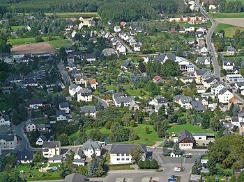
Oberwürschnitz (Neuwürschnitz)
Together with Neuwiese, Oberwürschnitz forms the district of Neuwürschnitz in the city of Oelsnitz / Erzgeb. .
Geographical location
The village lies on the Würschnitz . The A 72 runs to the south and east of the village, the Stollberg- West junction is in the immediate vicinity. Neuwiese is located southwest of Oberwürschnitz, and in the north is the Oelsnitz district of Neuoelsnitz and the municipality of Niederwürschnitz .
history
Oberwürschnitz emerged as a stately row village with forest hooves (1900: 500 ha) during the time of the eastward expansion. The first documentary mention as Obirnwirßnicz dates from 1447 , however. In 1840 the place was after Stollberg / Erzgeb. parish. In 1908 he got his own parish hall. The farmers from Oberwürschnitz had to go to Oelsnitz / Erzgeb. indulge. Two farmsteads still have upper arbours (Hartensteiner Str. 6 and 20), and there is also a half-timbered house built around 1780 (Hartensteiner Str. 113).
The numerous linen weavers and hosiery workers belonged to the Oelsnitz guilds. From the revolutionary days of 1848 it is reported that residents from Neuwiese and Oberwürschnitz took part in the train to Waldenburg on April 5th . The wage workers joined the labor movement early on. Wilhelm Liebknecht's first meeting with local workers took place in Oberwürschnitz in 1868. After 1919 the KPD and its mass organizations were strongly represented in both districts.
The cooperative farmers from Neuwürschnitz mainly worked in the field of cattle breeding and dairy farming in the LPG Albert Funk. Plant production took place on large fields, some of which were only made arable through melioration. The most modern technology of the time was used, including agricultural aircraft from the neighboring LPG Oelsnitz. Later, the large-scale drainage of ponds and bushes was viewed critically, as biotopes were destroyed that are now considered worthy of protection. Industrial production is insignificant.
The Oberwürschnitzer farm ponds
Each of the 17 former farms in Oberwürschnitz (today Neuwürschnitz ) had a pond, which, with one exception, was in the garden next to the farm. When individual cartographic photographs of the communities were made between 1835 and 1842 for the purpose of tax calculation, the “list of all the individual corridors and properties in fields, meadows, woodworks, cliffs and ponds within the corridor boundaries of the village of Oberwürschnitz” was created. The map and the directory were initially kept in each municipality, but were mostly lost, as in Oberwürschnitz. The state archive in Dresden keeps the originals.
In Oberwürschnitz there is no pond adjacent to the farm in the lower part of the village up to the Viehwegergut. You are on the Stollberger side at the corridor boundary, on the side to Oelsnitz in the middle of the corridor. During the relief improvement in 1973/74, the ponds were removed except for one at the edge of the forest and one at the hedges. The ponds adjacent to the courtyard were mainly used for flax in the second half of the 19th century , which was a very important crop at that time. In the ponds, the flax was soaked, “roasted”, and the green parts rot. That caused an unpleasant smell. A single field name, namely the "Ries", for a filled pond in the middle Anger reminds of the importance of the ponds for flax processing.
The nearby ponds, however, already had another job to do when building the homesteads. They were used as construction pits, in which the clay was trodden in the water to make it pliable and to free it of stones. The sticks wrapped in straw were smeared with clay, inserted into the framework and the resulting “clay corrugation wall” was completed by smoothing with clay. If such buildings are demolished or expanded today, you can see the construction methods of that time. At the Böttchergut (temporarily kindergarten) there was no space for a pond, because behind the house the terrain rose steeply and there was a small quarry there. The “construction pond” for this property was therefore on the Oelsnitz side next to another larger pond and was called the “clay hole”. The "clay hole" serving as a garbage dump and the neighboring pond were filled in during the improvement in 1972/74.
On April 1, 1934, Oberwürschnitz was combined with Neuwiese to form the new municipality of Neuwürschnitz , which in turn moved to Oelsnitz / Erzgeb on January 1, 1999 . was incorporated.
Individual evidence
- ^ Statistics of the German Reich - Volume 450, 3rd edition, Verlag für Sozialpolitik, Wirtschaft und Statistik GmbH, Berlin, 1936, publisher of the Statistisches Reichsamt
Web links
- Oberwürschnitz in the Digital Historical Directory of Saxony
Coordinates: 50 ° 42 ' N , 12 ° 44' E


