Olifants River (Western Cape)
|
Olifants River Cape Olifants River, Olifantsrivier |
||
|
Rivers in South Africa |
||
| Data | ||
| location | South Africa ( Western Cape Province ) | |
| source | north of Elandsfontein 33 ° 10 ′ 22 ″ S , 19 ° 12 ′ 36 ″ E |
|
| muzzle | at Papendorp in the Atlantic Coordinates: 31 ° 41 ′ 57 ″ S , 18 ° 11 ′ 20 ″ E 31 ° 41 ′ 57 ″ S , 18 ° 11 ′ 20 ″ E
|
|
| Reservoirs flowed through | Clanwilliam Dam , Bulshoek Dam | |
|
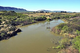
The Olifants River below the village of Klawer |
||
The Olifants River in the South African province of Western Cape (also Cape Olifants Rivier ) is an approximately 320-kilometer-long body of water that its headwaters on the slopes between Groot-Winterhoek Mountains and Skurfteberge has. The mouth of the Olifants River lies on the Atlantic .
course
Of morphological importance in its course is the breakthrough valley in the mountain ranges of the Koue Bokkeveld ( English Cold Bokkeveld ). The valley after this breakthrough runs through a region with little precipitation, which nevertheless enables favorable agricultural conditions due to the fog occurring here as an effect of the Benguela Current. A dry region extends on its lower reaches from the place Klawer . These climatic conditions gave the impetus for extensive irrigation systems. Initially, these were pumping stations and small weirs built from stone rubble. In 1905 a dam was planned at Bulshoek , which was finally built in 1922 with the help of Italian engineers about 25 kilometers north of Clanwilliam . The weir ( Bulshoek Barrage or Bulshoek Weir ) became part of the state Olifants River Irrigation Scheme (German: "Olifants River Irrigation System", currently: Olifants River (Vanrhynsdorp) Government Water Scheme ).
On the west side of the valley, a main irrigation canal branches off from the Bulshoek reservoir , which follows the further course of the valley via the villages of Klawer and Vredendal to near the mouth of the Atlantic . There is also a canal ( Doorn River Canal ) running east of the Olifants River in the valley , which also receives water from the periodically descending Doorn River ( Doringrivier ). Both canals enable extensive agricultural activities in the valley floor and contribute to the water supply of the Namakwa Sands Mine and other smaller mining companies. Small side valleys and Riedel have led to the construction of smaller aqueducts and tunnels in this canal system since 1957 .
In years between 1932 and 1935 the Clanwilliam Dam was built near the small town of the same name. More recently an elevation of the dam crest by about 13 meters has been considered. The construction work should be completed by 2023. Below this dam are numerous private weirs, pumping stations and smaller irrigation systems along the course of the river. The city of Clanwilliam gets its drinking water from the tributary Jan Disselsrivier, which flows here .
The Olifants River flows into the Atlantic Ocean near Papendorp and forms an estuary .
Dams
- Clanwilliam Dam (capacity 122 million m³)
- Bulshoek Weir (capacity 5.7 million m³)
Tributaries
- on the right: Holrivier, Troe Troerivier, Doringrivier, Kliphuisrivier, Jan Disselsrivier, Rondegatrivier, Heksrivier, Boontjiesrivier, Noordhoeksrivier, Theerivier, Oudsterivier
- Left: Rietvleirivier, Seekoeivleirivier, Elandskloofrivier, Palmietfonteinrivier
Individual evidence
- ↑ a b c Traugott Molter: Water balance and irrigation agriculture in the Cape . Franz Steiner Verlag , Wiesbaden 1966, pp. 82-84.
- ^ A b c Department of Water Affairs and Forestry: Olifants / Doorn Water Management Area. Internal Strategic Perspective . Report No. P WMA 17/000/00/0305, DWAF 2005, online at www.dwaf.gov.za (PDF, English)
- ↑ Linus Kemboi: Clanwilliam dam to be completed by 2023 . News from August 22, 2019 on www.constructionreviewonline.com (English)
- ^ Western Cape Government: Clanwilliam Dam wall comments welcomed . News from April 8, 2019 on www.westerncape.gov.za (English)

