Olteț (river)
| Olteț | ||
|
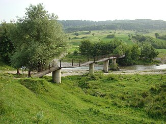
The Olteț near Nistoreşti |
||
| Data | ||
| location | Romania | |
| River system | Danube | |
| Drain over | Olt → Danube → Black Sea | |
| source | in the Munții Căpățânii near the Curmătura Oltețului pass 45 ° 20 ′ 41 ″ N , 23 ° 46 ′ 44 ″ E |
|
| muzzle | at the height of Fălcoiu in the Olt Coordinates: 44 ° 13 ′ 30 " N , 24 ° 25 ′ 39" E, 44 ° 13 ′ 30 " N , 24 ° 25 ′ 39" E
|
|
| length | 185 km | |
| Catchment area | 2474 km² | |
| Small towns | Bălceşti, Balş | |
The Olteț is a right tributary of the Olt (Alt) in Romania . It has its source in Gorj County and flows through Vâlcea County and Olt County .
geography
The Olteț rises in the Munții Căpățânii near the Curmătura Oltețului pass in the Southern Carpathians . It flows southwards, past the towns of Bălceşti , Balş and Osica de Sus and flows into the Olt at the height of Fălcoiu .
The length of the Olteț is 185 km; its catchment area is given as 2474 km², the mean discharge with 12.8 m³ / s.
