Eastermar
 flag |
 coat of arms |
| province |
|
| local community |
|
|
Area - land - water |
29.89 km 2 23.76 km 2 6.13 km 2 |
| Residents | 2,495 (Jan 1, 2017) |
| Coordinates | 53 ° 11 ' N , 6 ° 4' E |
| prefix | 0512 |
| Postcodes | 9221, 9233, 9258, 9261-9262, 9281, 9289 |
| Website | eastermar.nl |
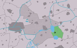
| Location of Eastermar in the municipality of Tytsjerksteradiel | |
Eastermar ( Dutch Oostermeer ) is a Dutch town in the province of Friesland with 2,495 inhabitants (as of January 1, 2017). It belongs to the municipality of Tytsjerksteradiel .
geography
Eastermar was built on a sand ridge and is surrounded by a hedge landscape. The remains of the earlier wall hedges can also be found in the new building areas. The village with its two marinas is located directly on the east bank of the Lits . This river connects the lake De Leien with the Burgumermar and is part of the Lits-Lauwersmeeroute. The two lakes are each about 500 meters from the town center.
origin of the name
The name 'Eastermar' means east of the lake and refers to the former center of the village. This original town center is now called 't Heechsân and is actually east of the Burgumermar .
The settlement on the Lits, founded around 1600, was initially called de Wâl . In the course of time this settlement grew and the number of inhabitants exceeded that of the original town center. When the center of the population shifted to the Lits, the name also shifted. From de Wal was Eastermar and from the original Eastermar was ' t Heechsân .
history
Around 1600 a fen settlement was founded on the Lits . The moor was dug up in this area until around 1750 . This led, among other things, to the creation of the nearby lake De Leien . After the peatland colonization there was no more work for the peatland workers. The population growth of the original town center 't Heechsân has since stalled, whereas Eastermar has continued to develop. Its location on the Lits made shipping and trade possible. In the vicinity of the village, numerous farms were built after the bog colonization. From 1904 to 1964 there was a dairy in the village . The loss of jobs due to the closure of the dairy was compensated for around 1960 with the construction of the new industrial park on the nearby Prinses-Margriet Canal . In 2007 the port area named De Komerk was completed.
Personalities
- Marten Baersma (1890–1918), Frisian author
- Doutzen Kroes (1985), photo model
- Dam Jaarsma (1914–1991), Frisian author and poet
Web links
- Place website (Dutch)
Individual evidence
- ↑ a b Kerncijfers wijken en buurten 2017. Centraal Bureau voor de Statistiek , accessed on June 20, 2018 (Dutch).
- ↑ Lits Lauwersmeerroute | Friesian Meren. (No longer available online.) Archived from the original on February 17, 2018 ; Retrieved February 24, 2018 (Dutch). Info: The archive link was inserted automatically and has not yet been checked. Please check the original and archive link according to the instructions and then remove this notice.
- ↑ Haven 'De Komerk' it simmerseizoen yn. January 27, 2007, accessed August 2, 2016 .


