Orašac
| Orašac | ||
|
|
||
| Basic data | ||
|---|---|---|
| State : |
|
|
| County : |
|
|
| Municipality : | Dubrovačko primorje | |
| Height : | 0 m. i. J. | |
| Area : | 4 km² | |
| Residents : | 546 (as of 2001 ) | |
| Population density : | 137 inhabitants per km² | |
| Telephone code : | (+385) 020 | |
| Postal code : | 20234 | |
| Boat registration : | DB | |
| Structure and administration | ||
| Community type : | settlement | |
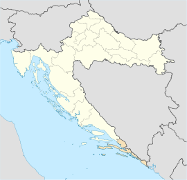
Orašac is a village in the Dubrovačko primorje municipality in the Croatian Dubrovnik-Neretva County .
Geographical location
The village is located 15 km northwest of the city of Dubrovnik and lies on the Jadranska Magistrala . The larger part of the village is on the mountain above the road, the smaller part below on the coast. Orašac is divided into 2 parts: Orašac and Poljice .
history
The name of the village is derived from the Croatian word orah (Eng. " Walnut ") and comes from the fact that walnut trees were grown in Orašac until the fall of the Republic of Ragusa . The name Orašac was first mentioned in 1040 . At that time the houses were built very close to each other to ensure a good defense against foreign powers. In 1399 , Orašac officially became part of the Ragusa Republic. During the Croatian War the village was occupied by the Yugoslav People's Army and the Chetniks , who burned almost all the houses.
economy
The people of Orašac are mostly engaged in summer tourism , their main source of income, and fishing . The Dubrovački vrtovi sunca hotel was built at the end of the 1980s and was completely destroyed and burned down during the Croatian war. The hotel is currently being rebuilt.
population
Most of the people in Orašac are Croatians and according to the 2001 census there are 546 people in the village.

