Oril
|
Oril Оріль, Орель / Orel ' |
||
| Data | ||
| location | Kharkiv oblast , Poltava , Dnipropetrovsk Oblast ( Ukraine ) | |
| River system | Dnepr | |
| Drain over | Dnepr → Black Sea | |
| source | on the Donez ridge 49 ° 26 ′ 6 ″ N , 36 ° 4 ′ 59 ″ E |
|
| muzzle | at Obuchiwka in the Dnieper Coordinates: 48 ° 31 ′ 15 " N , 34 ° 52 ′ 47" E 48 ° 31 ′ 15 " N , 34 ° 52 ′ 47" E
|
|
| length | 346 km | |
| Catchment area | 9800 km² | |
| Left tributaries | Orilka , Bagatenka , Schiróka Kílchenka and Mokra Zaplawka | |
| Right tributaries | Ortschyk , Bagata , Berestowá , Orchik and Lipjánka | |
| Small towns | Pereshchepyne , Zarytschanka , Obuchiwka | |
| Communities | Mohyliw | |
|
Rivers in the system |
||
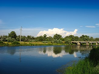
The Oril ( Ukrainian Оріль ; Russian Орель / Orel ' ) is a left tributary of the Dnepr in Ukraine .
The Oril has a length of 346 km and a catchment area of 9,800 km². It rises on the Donets Ridge near the village of Yefremiwka in the Pervomajskyj district in the Ukrainian Oblast of Kharkiv and flows into the Dnieper at the urban-type settlement Obuchiwka not far from the city of Dnipro .
Largest tributary with a length of 108 km and a catchment area of 1,460 km² is the Ortschyk . Larger towns on the river are Pereshchepyne , Zarytschanka and Obuchiwka .
The Dnepr-Oril floodplains are one of the protected Ramsar areas in Ukraine .
Web links
Commons : Oril - collection of images, videos and audio files

