Oromocto
| Oromocto | ||
|---|---|---|
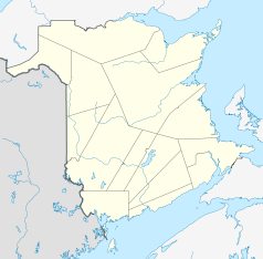
| Location in New Brunswick | ||
|
|
||
| State : |
|
|
| Province : | New Brunswick | |
| County: | Sunbury County | |
| Coordinates : | 45 ° 51 ′ N , 66 ° 29 ′ W | |
| Height : | 25 m | |
| Area : | 22.37 km² | |
| Residents : | 8932 (as of 2011) | |
| Population density : | 399.3 inhabitants / km² | |
| Time zone : | Atlantic Time ( UTC − 4 ) | |
| Postal code : | E2V 2V3 | |
| Area code : | +1 506 | |
| Mayor : | Robert Powell | |
| Website : | www.oromocto.ca | |
Oromocto is a city in the Canadian province of New Brunswick . The population in 2011 was 8932 people.
geography
Oromocto is in Sunbury County . The Oromocto River flows on the western edge and the Saint John River on the north . The connecting roads New Brunswick Route 102 and New Brunswick Route 2 run through the village. Fredericton is about 20 kilometers to the northwest. The Fredericton International Airport is bordered on the northwest by Oromocto.
history
The original inhabitants of the region were the Algonkinindianer that the town and the river wel-a-mook-Took ( deepwater called = deep water). The settlers later developed the name Oromocto from this . These came from France in the 1600s and also from England in the 1760s . The main livelihoods of the inhabitants were wood and forestry as well as shipbuilding. In 1956 the place received city rights. With the construction of the CFB Gagetown military training area , the place experienced a strong boom and many new companies settled there. This gave the city a model status and was referred to as Canada's Model Town . The Canadian Forces Base Gagetown Military Museum and New Brunswick Military History Museum are located in Oromocto.
sons and daughters of the town
- Corey Neilson , ice hockey player
Web links
- Attractions - New Brunswick Military History Museum
- museumgagetown - Canadian Forces Base Gagetown Military Museum
Individual evidence
- ↑ Statistics Canada - Census Oromocto 2011
- ^ History
- ↑ army forces gagetown
- ↑ Oromocto ( English, French ) In: The Canadian Encyclopedia .
