
Otterburn (Northumberland)
| Otterburn | |||
|---|---|---|---|
|
|||
| Coordinates | 55 ° 14 ′ N , 2 ° 11 ′ W | ||
| Basic data | |||
| Country | United Kingdom | ||
|
Part of the country |
England | ||
| county | Northumberland | ||
| ISO 3166-2 | GB-NBL | ||
 |
|||

Otterburn is a small town in Northumberland , England , 50 kilometers northwest of Newcastle upon Tyne on the banks of the River Rede near the confluence of the Otter Burn - the place is named after this stream. Otterburn is located in the Cheviot Hills in Redesdale , named after the River Rede , just 16 miles from the Scottish border.
The Otterburn Training Area , one of the largest military training areas of the British Army (240 km²) is very close to the village.
history
In 1388 the great Battle of Otterburn between an English and a Scottish army took place here. The Scot James Douglas, 2nd Earl of Douglas invaded northern England, where he wanted to take advantage of the rivalry between the two English aristocrats Ralph Neville, 1st Earl of Westmorland and Henry Percy, 1st Earl of Northumberland . James Douglas was killed in the battle, but the Scots captured Henry Percy , son of the earl of the same name and military leader in the battle, and achieved victory. The dead, more than 1,000 Englishmen and 200 Scots, were taken to St. Cuthbert's Church in the Alnwick district , approximately 3 miles from the battlefield, and buried there.
Picture gallery
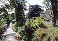
The Otter Burn at Otterburn

Otterburn Bridge and River Rede
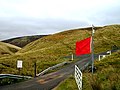
Otterburn Training Area

St. John the Evangelist

Otterburn Mill (now a restaurant)

Battle of Otterburn display board


