Overloon
 flag |
 coat of arms |
| province |
|
| local community |
|
|
Area - land - water |
29.22 km 2 29.15 km 2 0.07 km 2 |
| Residents | 3,965 (Jan 1, 2018) |
| Coordinates | 51 ° 34 ′ N , 5 ° 57 ′ E |
| Important traffic route |
|
| prefix | 0478 |
| Postcodes | 5804, 5815, 5821, 5824-5826, 5843-5844 |
| Location of Overloon in Boxmeer parish | |
Overloon is a village in the municipality of Boxmeer in the east of the province of Noord-Brabant ( Netherlands ) near Germany. Overloon is located in a wooded area between “de Peel” ( moorland ) and the Meuse . It has about 3965 inhabitants (as of January 1, 2018).
During the Second World War , Overloon was completely destroyed during one of the largest tank battles in October 1944 . After the war, a National War and Resistance Museum was established here .
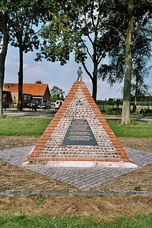
In the village there is the modern Theobalduskirche (1956) modeled on the architect le Corbusier . War memorials and a British military cemetery are also worth seeing.
Overloon is now a holiday village with campsites, a holiday park and a zoo.
Worth seeing
Web links
Commons : Overloon - collection of images, videos and audio files
- Website of the Overloon War Museum (German, Dutch, English)
- Overloon Zoo website (German, Dutch, English)
Individual evidence
- ↑ a b Kerncijfers wijken en buurten 2018 . In: StatLine . Centraal Bureau voor de Statistiek , October 26, 2018, accessed on December 23, 2018 (Dutch)


