Peetri (Harjumaa)
| Peetri | ||
| State : |
|
|
| Circle : |
|
|
| Coordinates : | 59 ° 24 ' N , 24 ° 49' E | |
| Area : | 4.60 km² | |
| Residents : | 4,435 (December 31, 2011 ) | |
| Population density : | 964 inhabitants per km² | |
| Time zone : | EET (UTC + 2) | |
|
|
||
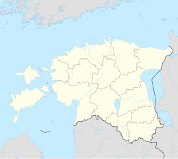
Peetri (in colloquial language also Peetriküla ; historical German name Petrikülla ) is a village ( küla ) in the municipality of Rae in the Harju (Rugel) district in Estonia . It borders the capital Tallinn .
geography
Peetri is the largest settlement in Estonia with the status of a village ( küla ). According to the official population register, on January 1, 2012, Peetri had a population of 3,012.
There are more than 500 houses in the village, including a few dozen apartment houses. In autumn 2009 the construction of a building complex was completed in which kindergarten and elementary school, sports hall, stadium and a public library are housed.
Most of the village is west of the E263 Tallinn - Tartu - Võru - Luhamaa motorway , but it also includes part of Mõigu ( Moik ) east of the motorway. The place extends over an area of 4.60 km².
history
The first written mentions of Peetris from 1631 can be found in connection with a real estate transaction of the Mõigu estate. In 1732 the Estonian farmer Wanna-Peter was resettled on the Mõigu courtyard east of the then major military road. The later village of Peetri emerged from this settlement.
The oldest preserved building in Peetri is a former windmill from 1868, which is now used as the Peetri Tuulik restaurant (German: "Peetri Windmill").
literature
- Baltic historical local dictionary. Part 1: Estonia (including Northern Livonia). Started by Hans Feldmann . Published by Heinz von zur Mühlen . Edited by Gertrud Westermann . Cologne, Vienna 1985 (= sources and studies on Baltic history. Volume 8/1), ISBN 3-412-07183-8 , p. 449.
Web links
- Peetri website (Estonian)
- Historic Peetri Windmill (Estonian, English, Russian)

