
Harju County
| coat of arms | map |
|---|---|
.svg)
|
  |
| Basic data | |
| ISO code : | EE-37 |
| Administrative headquarters : | Tallinn |
| Area : | 4,333 km² |
| Residents : | 572,103 (January 1, 2014) 1 |
| Population density : | 121 inhabitants per km² |
| Circle structure: | 12 municipalities 4 cities |
| Address of the district administration: |
Roosikrantsi 12 15077 Tallinn |
| Website : | harju.maavalitsus.ee |
| politics | |
| Governor : | Ülle Rajasalu (since 2009) |
|
1 Estonia Statistics Office, database request, September 12, 2014 |
|
| 2 In 2002 the city of Kehra was merged with the municipality of Anija , in 2005 the municipalities of Loksa and Kuusalu , see Place Names Board of Estonia (English) | |
The Harju County (Estonian maakond Harju or Harjumaa , German Harrien ) is a county (maakond) in Estonia .
geography
Harju County, which also includes Tallinn , the capital of Estonia , is located on the southern coast of the Gulf of Finland and borders with the counties of Lääne in the south-west, Rapla and Järva in the south and Lääne-Viru in the east.
cities and communes
Since the administrative reform in 2017, Harju County has consisted of four cities and 12 rural communities:
Cities
Communities
- Anija (Annia)
- Harku (Hark)
- Jõelähtme (Jegelecht)
- Kiili
- Kose (kosh)
- Kuusalu (Kusal)
- Lääne-Harju (West Harrien)
- Raasiku (Rasik)
- Rae (Johannishof)
- Saku (sack)
- Pig
- Viimsi

Church structure before 2017
Cities
Communities
- Aegviidu (Charlottenhof)
- Anija (Annia)
- Harku (Hark)
- Jõelähtme (Jegelecht)
- Keila
- Kernu (Kirna)
- Kiili
- Kose (kosh)
- Kuusalu (Kusal)
- Nissi
- Padise (Padis)
- Raasiku (Rasik)
- Rae (Johannishof)
- Saku (sack)
- Pig
- Vasalemma (Wassalem)
- Viimsi

Tuhala Witch Fountain , Kose Municipality

Manor house in Kiviloo, Raasiku Township

Manor house in Laitse, Kernu parish

Church in Kose
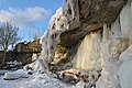
Jägala waterfall , Jõelähtme municipality

Paldiski Bay

Manor house in Aruküla , Raasiku Municipality


Web links
Commons : Harju County - Collection of images, videos and audio files