Kehra
| Kehra | ||
|
||
| State : |
|
|
| Circle : |
|
|
| Coordinates : | 59 ° 20 ′ N , 25 ° 19 ′ E | |
| Height : | 54 m | |
| Area : | 3.83 km² | |
| Residents : | 3,077 (2007) | |
| Population density : | 803 inhabitants per km² | |
| Time zone : | EET (UTC + 2) | |
| Telephone code : | (+372) 060 | |
| Postal code : | 74306 | |
| Mayor : | Jüri Lillsoo | |
| Postal address : | Kreutzwaldi 74306 Kehra |
|
| Website : | ||
|
|
||
Kehra ( German Kedder ) is a small town in northern Estonia .
location
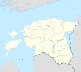
Kehra is located in Harju County . The city administratively belongs to the rural municipality of Anija . It is located on the Jägala River.
history
Kehra was first mentioned in 1241 in the Liber Census Daniæ . In the 1620s / 30s the Kedder Manor ( Kehra mõis ) was built on an old watering place.
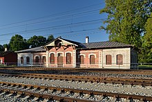
The actual beginning of the settlement is related to the construction of the railway line from Reval (today: Tallinn) to Narva in the 19th century. In 1876 Kedder got its own train station and grew rapidly. In 1938 a paper mill was founded, which accelerated the economic upturn. The Soviet occupying power expanded it, especially in the 1950s and 1960s.
In 1945 Kehra was granted the status of a large village ( alevik ). In 1993 it received city rights.
Attractions
The historic manor house of Kehra is worth seeing. The current building was erected in the 1820s by the then Baltic German owner Friedrich August von Maydell as an early classical timber structure. In the 19th century, the estate and its buildings were donated to the Estonian Agricultural Association ( Eestimaa Põllumajanduse Selts ).
Distances
- Tallinn : 39 km
people
- Silvi Vrait (1951–2013), pop and jazz singer
Web links
- Website of the municipality of Anija and the city of Kehra (Estonian)
- Kehra Manor (Estonian)


