
Harku
| Harku | |||
|
|||
| State : |
|
||
| Circle : |
|
||
| Coordinates : | 59 ° 8 ′ N , 24 ° 22 ′ E | ||
| Area : | 159.8 km² | ||
| Residents : | 14,123 (January 1, 2018) | ||
| Population density : | 88 inhabitants per km² | ||
| Time zone : | EET (UTC + 2) | ||
| Postal address : | Ranna tea 1 76901 Tabasalu |
||
| Website : | |||

|
|||


Harku (German Hark ) is a rural community in the Estonian district of Harju with an area of 159.8 km². It has 14,123 inhabitants (as of January 1, 2018).
history
The community of Harku was created in 1891 by merging several villages as a separate administrative unit.
Cities & Villages
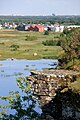
In addition to the main town Harku, the municipality (in descending order of size) includes the villages Tabasalu, Harkujärve, Tiskre, Rannamõisa, Laabi, Sõrve, Liikva, Vaila, Vääna , Vahi , Tutermaa, Kumna , Kütke, Humala, Adra, Türisalu, Naage, Vääna -Jõesuu , Viti, Suurupi, Muraste and Ilmandu.
Attractions
Hark Manor
The landlords were the Uexküllen , Budbergen , Ungern-Sternbergen , until 1919.
Faehna Manor
The German-Baltic manor house of Faehna (today: Vääna ), which was first documented in 1325, is particularly worth seeing . Today's main house was built in the late Baroque style in 1784 . Otto Magnus von Stackelberg was the landlord of this manor house. A primary school has been located on the premises since the 1920s.
Tabasalu

Muraste

Rannamõisa

Ranna

Vahiküla

Suurupi


Web links
- Website of the municipality of Harku (Estonian and English)