
Circle Hiiu
| coat of arms | map |
|---|---|

|
  |
| Basic data | |
| ISO code : | EE-39 |
| Administrative headquarters : | Kärdla |
| Area : | 1023 km² |
| Residents : | 8,589 (January 1, 2014) |
| Population density : | 8.4 inhabitants per km² |
| Circle structure: | 1 parish |
| Website : | hiiumaa.ee/ |
| politics | |
| Governor : | Riho Rahuoja (since 2012) |
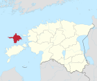
The district of Hiiu (Estonian Hiiu maakond or Hiiumaa , German Dagö ) is a district (maakond) in Estonia . In terms of both population and area, it is the smallest of the 15 districts. It mainly consists of the second largest Estonian island Hiiumaa and several smaller islands.
In the east, Hiiu borders on the district of Lääne , in the south on the district of Saare and in the west and north on the Baltic Sea .
geography
The district of Hiiu consists of the islands Hiiumaa (965 km²) and Kassari (19 km²) as well as other small islands. The highest point is the Tornimägi with 68 m. The longest river is the Luguse (21 km).
Community structure

As of 2017, Hiiu County has only consisted of one parish, Hiiumaa rural parish .
From 2013 to 2017 the district was divided into the four rural communities (vald) Emmaste , Hiiu , Käina and Pühalepa . The rural community of Hiiu was created in 2013 as a merger of the city of Kärdla (Kertel) with the rural community of Kõrgessaare (Hohenholm) .
| local community |
Area km² |
Residents |
Population density / km² |
|
|---|---|---|---|---|
| 1 | Emmaste vald (Emmast) | 197.5 | 1.108 | 5.6 |
| 2 | Hiiu vald | 388 | 4.159 | 12.8 |
| 3 | Käina vald (Keinis) | 186.5 | 1,878 | 10.1 |
| 4th | Pühalepa vald (Pühhalep) | 255.5 | 1,437 | 5.6 |
| Hiiu maakond (Dagö) | 1023 | 8,582 | 8.4 |
Web links
Individual evidence
- ↑ http://www.stat.ee/67696 Estonia Statistics Office.
- ^ Estonia Statistics Office, database request, September 12, 2014
- ↑ As of January 1, 2015