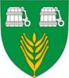
Käina (rural community)
| Käina | |||
|
|||
| State : |
|
||
| Circle : |
|
||
| Founded : | September 10, 1992 | ||
| Coordinates : | 58 ° 50 ′ N , 22 ° 48 ′ E | ||
| Area : | 188 km² | ||
| Residents : | 1,835 (2011) | ||
| Population density : | 10 inhabitants per km² | ||
| Time zone : | EET (UTC + 2) | ||
| Community type: | former rural community | ||
| Postal address : | Hiiu maantee 28 92101 Käina |
||

|
|||
The rural municipality Käina ( Käina vald ) is a former municipality in the southeast of the Estonian district of Hiiu .
description
Käina was one of the four rural communities on the second largest Estonian island Hiiumaa . The rural community covered an area of 188.5 km². 126 km² were forest areas. The island of Kassari and numerous smaller islands and islets in the Baltic Sea also belonged to the municipality .
The rural community had 1,835 inhabitants (December 31, 2011). A major demographic challenge was emigration and an aging population.
The most important settlements were the main town Käina ( Käina alevik ) and the villages of Männamaa , Putkaste and Kassari . The seat of administration, a grammar school and the local cultural center were located in the municipal capital. In addition, there was a swimming pool, inaugurated in 2003, the library and a family medical center.
The port of Orjaku is of economic and tourist importance .
history
The parish of Käina was founded after 1254. The area comprised the current rural community and parts of the adjacent rural community Emmaste . It was under the bishop of Saare-Lääne (German Ösel-Wiek ). The center was located on the Alliksaare diocese (now part of the Sinima village ). In 1627 the parish Reigi and in 1866 the parish Emmaste were separated. In 2017 all parishes on Hiiumaa merged to form the new rural parish Hiiumaa.
Villages
In addition to the main town Käina belonged to the rural community of the villages Aadma , Allika , Esiküla , Jõeküla , Kaasiku , Kaigutsi , Kassari , Kleemu , Kogri , Kolga , Kuriste , Laheküla , Lelu , Ligema , Luguse , Moka , Mäeküla , Mäeltse , Männamaa , Nasva , Niidiküla , Nõmme , Nõmmerga , Orjaku , Putkaste , Pärnselja , Ristivälja , Selja , Taguküla , Taterma , Ühtri , Utu , Vaemla and Villemi .
Attractions
The bay of Käina opens up an impressive panorama of the Baltic Sea and the offshore island of Kassari . The area attracts numerous nature lovers and ornithologists.
The symbol of the community were the remains of a stone church from the 15th / 16th centuries. Century in the capital Käina. The church was badly damaged in 1941 during World War II . A historic chapel has been preserved in the village of Esiküla on Kassari .
The museum in the birth house of the Estonian composer Rudolf Tobias was well worth seeing . It was located in the village of Selja . Tobias was born in Käina in 1873 and died in Berlin in 1918 .
The Käina Folk music festival has been held every July since 2005 . It brought Estonian and international bands together and attracted numerous visitors.
photos
Ruins of the old church of Käina
Former mansion of the Putkaste estate
Kuriste Orthodox Church
Windmill on Kassari Island
Chapel in Esiküla
Web links
Individual evidence
- ↑ Archived copy ( Memento of the original from May 11, 2013 in the Internet Archive ) Info: The archive link was inserted automatically and has not yet been checked. Please check the original and archive link according to the instructions and then remove this notice.
- ↑ http://www.eestigiid.ee/?CatID=272


