
Rural community of Muhu
| Muhu | |||
|
|||
| State : |
|
||
| Circle : |
|
||
| Coordinates : | 58 ° 36 ' N , 23 ° 14' E | ||
| Area : | 198 km² | ||
| Residents : | 1,564 (January 1, 2014) | ||
| Population density : | 8 inhabitants per km² | ||
| Time zone : | EET (UTC + 2) | ||
| Telephone code : | (+372) 045 | ||
| Postal code : | 90701 | ||
| Community type: | Rural community | ||
| Structure : | 52 villages | ||
| Mayor : | Raido Liitmäe
( IRL ) |
||
| Postal address : | Vallamaja 90701 Liiva |
||
| Website : | |||

|
|||


The rural community of Muhu (Estonian Muhu vald ) is located in the west of the Republic of Estonia . It includes the third largest Estonian Baltic Sea island Muhu (German Moon ) and surrounding smaller islands.
Administrative division
The rural community of Muhu belongs to the Saare district ( Saare maakond ). To her total includes 52 villages: Aljava , Hellamaa , Igaküla , Kallaste , Kantsi , Kapi , Kesse , Koguva , Külasema , Kuivastu , Laheküla , Lalli , Leeskopa , Lehtmetsa , Lepiku , Levalõpme , Linnuse , Liiva , Lõetsa , Moega , Mõisaküla , maela , Nautse , Nõmmküla , Nurme , oină , Pädaste , Päelda , Paenase , Pärase , Pallasmaa , Piiri , Põitse , Raegma , Rannaküla , Raugi , Rebaski , Ridasi , Rinsi , Rootsivere , Rässa , Simisti , Soonda , Suuremõisa , Tamse , Tupenurme , Tusti , Vahtraste , Vanamõisa , Viira , Võiküla , Võlla . The main town is Liiva , located in the center of the island .
The largest islands belonging to the rural municipality of Muhu are Kesselaid , Suurlaid , Viirelaid and Võilaid .
Population
The rural community has 1,564 inhabitants (as of January 1, 2014).
photos

Pädaste manor house

Liiva Pastorate

Museum of Koguva

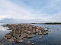
Koguva port

Hellamaa Orthodox Cemetery

Hellamaa Orthodox Church
Headland of the island of Kesselaid

Püssinina cliff ( Lõetsa village )


