Pemsaschen
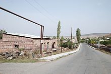
Pemzaschen , Pemzashen ( Armenian Պեմզաշեն , "built from pumice "), from the 19th century to 1940 Mahmudcuk ( Mahmnutcuk, Magmudzhuk ), is a village in the northwestern Armenian province of Shirak with 3322 inhabitants according to the official statistics from January 2012. In the center of the village the ruins of a building complex of three churches, which are dated to the 6th to 7th centuries, remained.
location
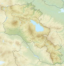
Coordinates: 40 ° 35 ′ 36 ″ N , 43 ° 56 ′ 24 ″ E
Pemzaschen is located at an altitude of 1872 meters on the northwestern foothills of the Aragaz mountain five kilometers southwest of the small town of Artik . On the grassy, stony and treeless hills in the area, mainly cattle is raised. Arable farming does not take place there.
In Maralik, about 30 kilometers south of Gyumri , a road branches off the M1 between Yerevan and Gyumri to the east, which leads past Pemzashen first to Artik and later over the plateau of Tsaghkahovit towards Vanadzor in the northeast of the country.
On the road that leaves Pemzaschen to the south, keep left at the first junction after three kilometers to reach the higher village of Lernakert . Halfway there are the ruins of the Sion Church ( Surb Sion ) from 1001 of the former Makaravank monastery from the 10th to 13th centuries. Nearby, from the edge of a small ravine below on the rock face, you can see a chapel with a grassy gable roof from the 18th century.
Like Satani-Dar, Areguni and Arzni, Pemzaschen is one of the sites of the Middle Paleolithic in the Aragaz region, where stone tools but no skeletons were discovered, and like Garnahovit one of the places with Cyclopean fortresses that stood on numerous hilltops in the Late Bronze Age .
Townscape
At the 1989 census, the population was 3,384. The rural exodus that began with the economic decline after the end of the Soviet era in 1991 led to a population decline. In 2001 the census showed 2862 inhabitants. By 2012 the level of 1989 had been reached again.
The fruit and vegetables grown in the homesteads' gardens in addition to cattle are used for self-sufficiency. The center of the village is a tree-lined park with a fountain, near which there are some small grocery stores. On the opposite side of the street, the church ruins are hidden behind a row of houses.
Churches
The preserved church ruins made of pink tuff in the center of the village are located in a hollow about two meters below the level of the surrounding area. A larger church was built over the three original churches, which can only be dated by comparing styles. The remains of the wall have now been completely removed.
Hall church
Probably in the 5th or 6th century, an elongated single-nave church was built, of which the lowest stone layer of the walls was exposed over a stepped plinth in 1976. The building formed a rectangle about 6.6 × 19 meters with a horseshoe-shaped apse that emerged as a pentagon from the east wall. The wall thickness was about 1.6 meters. A three-tier substructure emerged on the east side. As in the church of Lernakert, three belt arches supported on pairs of wall pillars divided the barrel vault . The two entrances were in the west and in the central south wall. The preserved bases of the pilasters show stacked tori , dew sticks and similar moldings.
Trikonchos
Heavily damaged, but best preserved within the ensemble is a church with trikonchos , in which three horseshoe-shaped apses are arranged around a square central space, while the western arm has been significantly lengthened with a rectangular shape. In the earliest small cross- domed churches ( Lmbatavank or the Mother of God Church of Talin from the 7th century), the shape of the cross remains in the outline of the building. The church of Pemzaschen, on the other hand, belongs to a type in which all side arms are completely covered and enclosed within an outer rectangle. It was built with its northwest corner on the southern apse of the hall church. The internal dimensions are 5.86 × 7.48 meters.
In the corners between the conches, there are rectangular side rooms vaulted by barrels on three floors, which are not directly accessible from the main room as usual, but only via narrow corridors from the east cone. Manuscripts or church treasures may have been kept in these well-hidden rooms. Round arches span the inner corners of the wall and form a square. The transition to the octagonal cross-section of the drum is made by trumpets in the four corners. Eight more trumpets lead from the drum to the base circle of the dome, which is missing today. The inner walls of the drum are lively structured by round niches with final archivolts on each side and with windows in the main directions. Fan-shaped relief patterns with arches, rings, medallions and balls above the trumpets result in an extraordinarily varied design. On the outside of the diagonal wall surfaces between the windows, stones in the form of inscription tablets ( tabula ansata ) are attached.
The figural relief on the outside of the lintel above the entrance door is only preserved on the right-hand side. You can see the portrait of Mary with the baby Jesus on her left arm. She is adored by two smaller figures on her sides who could be the donors. Of the two angels hovering above the figures, the right angel protruding in the form of a round sculpture has been preserved. The friezes above the arched windows are also lavishly designed with horseshoe shapes , palmettes and braided ribbons. The image of Mary and other motifs seem to have been taken from Byzantine iconography of the first half of the 7th century. It is therefore dated to the middle of the 7th century.
chapel
The single-nave chapel, which is largely upright up to the edge of the eaves, borders the south wall of the trikoncho and stands with it on a shared two-tiered base. It measures around 3 × 5 meters inside with a wall thickness of one meter. The rectangular room with a horseshoe-shaped east apse is illuminated by a round arched window in the south and east walls. Four tabulae ansatae like those on the drum can also be found on the south wall, another fills the tympanum field above the lintel on the west side. The building sculpture suggests that it was created at the same time as the trikonchos.
Makaravank
The church of Makaravank on the road to Lernakert was a jacketed cross-domed church with a semicircular choir apse. The rectangular side rooms in the east were accessible from the side arms. In the corners of the west side, instead of side rooms, there are rectangular open wall niches. Large parts of the outer walls and two of the four belt arches that once supported the tambour have been preserved.
At a later time, a gawit with a transverse barrel was built on the west side , of which a remnant of the wall on the northern narrow side has been preserved and whose vault outline can be seen on the wall.
literature
- Paolo Cuneo: Architettura Armena dal quarto al diciannovesimo secolo. Volume 1. De Luca Editore, Rome 1988, pp. 240-242
- Annegret Plontke-Lüning: Early Christian architecture in the Caucasus. The development of Christian sacred buildings in Lazika, Iberia, Armenia, Albania and the border regions from the 4th to the 7th century (Austrian Academy of Sciences, Philosophical-Historical Class, Volume 359. Publications on Byzantium Research, Volume XIII) Verlag der Österreichische Academy of Sciences, Vienna 2007, enclosed CD-ROM: Catalog of preserved church buildings, pp. 251–253, ISBN 978-3700136828
- Jean-Michel Thierry: Armenian Art . Herder, Freiburg 1988, ISBN 3-451-21141-6
Web links
- Rick Ney: Shirak Marz. (PDF; 1.9 MB) Tour Armenia Travel Guide, p. 14f
Individual evidence
- ^ RA Shirak Marz. (PDF; 150 kB) armstat.am
- ↑ Rick Ney, p. 14
- ^ Elisabeth Bauer-Manndorff: The early Armenia. Basics of archeology and prehistory. Verlagbuchhandlung der Mechitaristen-Congegration, Vienna 1984, p. 32
- ^ Adam T. Smith, Ruben S. Baldayan, Pavel Avetisyan: The Foundations of Research and Regional Survey in the Tsaghkahovit Plain, Armenia. (The Archeology and Geography of Ancient Transcaucasian Societies, Volume 1) The Oriental Institute of the University of Chicago, 2009, p. 14
- ↑ Всесоюзная перепись населения 1989 г. demoscope.ru
- ^ RA 2001 Population and Housing Census Results. (PDF; 932 kB) armstat.am
- ↑ Jean-Michel Thierry, p. 85
- ^ Patrick Donabédian: Documentation of the art places . In: Jean-Michel Thierry, p. 572
- ↑ Jean-Michel Thierry, p. 177
- ↑ Paolo Cuneo, p. 242


