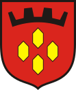
Piastów
| Piastów | ||
|---|---|---|

|
|
|
| Basic data | ||
| State : | Poland | |
| Voivodeship : | Mazovia | |
| Powiat : | Pruszków | |
| Area : | 5.76 km² | |
| Geographic location : | 52 ° 11 ' N , 20 ° 50' E | |
| Residents : | 22,619 (Jun. 30, 2019) |
|
| Postal code : | 05-820 | |
| Telephone code : | (+48) 22 | |
| License plate : | WPR | |
| Economy and Transport | ||
| Rail route : | Warsaw – Skierniewice | |
| Gmina | ||
| Gminatype: | Borough | |
| Residents: | 22,619 (Jun. 30, 2019) |
|
| Community number ( GUS ): | 1421011 | |
Piastów is a city and seat of the municipality of the same name in the powiat Pruszkowski of the Masovian Voivodeship , Poland . It is a suburb of the Polish capital, Warsaw, and is approximately 13 kilometers from the center of Warsaw.
Personalities
- Tadeusz Iwiński (* 1944), Polish politician
Individual evidence
- ↑ a b population. Size and Structure by Territorial Division. As of June 30, 2019. Główny Urząd Statystyczny (GUS) (PDF files; 0.99 MiB), accessed December 24, 2019 .
