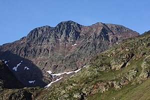
Pica d'Estats
| Pica d'Estats | ||
|---|---|---|
| height | 3143 msnm | |
| location | Spain / France border | |
| Mountains | Pyrenees | |
| Coordinates | 42 ° 40 ′ 0 ″ N , 1 ° 23 ′ 0 ″ E | |
|
|
||
| First ascent | First known ascent in 1864 by Henry Russell and Jean-Jacques Denjean. | |
| particularities | highest mountain in Catalonia | |
Pica d'Estats ( Spanish and Catalan Pica d'Estats , French Pique d'Estats or Pic d'Estats ) is a mountain in the Pyrenees , on the border between France and Spain, and the highest mountain in Catalonia . Together with the neighboring Pic de Montcalm , it is the easternmost three-thousand-meter peak in the Pyrenees.
The summit is located in the Catalan comarca Pallars Sobirà and the French department of Ariège . The summit consists of three very closely spaced peaks. The middle peak is 3143 m high, the western Pic de Verdaguer 3131 m and the eastern Punta Gabarró is 3115 m high. The ridge runs in a north-westerly direction along the Spanish-French border.
The documented first ascent was made in 1864 by Henry Russell and Jean-Jacques Denjean .

