Pima (Arizona)
| Pima | |
|---|---|
|
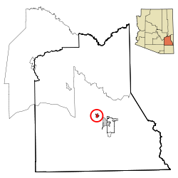
Location in County and Arizona
|
|
| Basic data | |
| Foundation : | 1879 |
| State : | United States |
| State : | Arizona |
| County : | Graham County |
| Coordinates : | 32 ° 53 ′ N , 109 ° 50 ′ W |
| Time zone : | Mountain Standard Time ( UTC − 7 ) |
| Residents : | 1,965 (as of: 2006) |
| Population density : | 302.3 inhabitants per km 2 |
| Area : | 6.6 km 2 (about 3 mi 2 ) of which 6.5 km 2 (about 3 mi 2 ) is land |
| Height : | 865 m |
| Postcodes : | 85535, 85543 |
| Area code : | +1 928 |
| FIPS : | 04-55560 |
| GNIS ID : | 0009433 |
Pima is a place in Graham County in the US state of Arizona . It has 1989 inhabitants on an area of 6.6 km². The population density is 303.5 / km². Pima is on the Gila River . It is named after the Pima Indian tribe . US Highway 70 runs through the town .
Nearby parks and recreation areas include Coronado National Forest and Hot Wells Dunes .
