Plänterwald
|
Plänterwald
|
||
| location | Berlin-Plänterwald & Baumschulenweg , Germany | |
| surface | 89.65 ha | |
| Identifier | LSG-46 | |
| WDPA ID | 323681 | |
| Geographical location | 52 ° 29 ' N , 13 ° 29' E | |
|
|
||
| Setup date | September 24, 1998 | |
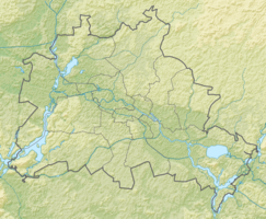
The Plänterwald is a conservation area protected forest area in the Berlin districts Plänterwald and Baumschulenweg of Treptow-Koepenick . The forest area is bordered by Neue Krugallee in the west, Bulgarische Strasse and the Spree in the north and east and Baumschulenstrasse in the south.
Protected position
The Plänterwald was declared a landscape protection area in accordance with Sections 18 and 20 of the Berlin Nature Conservation Act of January 30, 1979 (GVBl. P. 183), last amended by Article III of the law of July 4, 1997 (GVBl. P. 376). The Protected Areas Ordinance came into force on September 24, 1998.
Naming and history
In forestry, the name Plänterwald (or Plenterwald ) refers to a forest area in which trees of different ages grow together that are felled ( plowed ) individually and at different times . The Plänterwald is a forestry area that was part of the Cöllnische Heide between 1823 and 1840 . After that he was completely cleared in large areas for firewood production. The Schlesische Busch and the old Treptower Park are left over from the former forest area. From 1876 to 1884 reforestation took place on the initiative of the horticultural director Gustav Meyer . Treptow Park was as a public park created in the rest of Plänterwald planted gardener contrast, forest trees back to. The forest area has belonged to the Berlin forest authority since 1988.
Protection purpose and use
The aforementioned ordinance on landscape protection states: “(1) [...] the efficiency of the natural balance in one of the last inner-city forest areas in Berlin in the Treptower Spreetal lowlands with its diverse, predominantly very old trees close to the groundwater as a habitat for protected animal and plant species preserve [...], (2) the beautiful landscape, which in its peculiarity as a river-accompanying deciduous forest, characterizes the Spree and (3) preserve the area because of its special, overarching importance for recreation ”.
An approximately five kilometer long circular path runs through the entire Plänterwald. It is used by cyclists and joggers, among others. In addition, the European cycle route R1 leads through the Plänterwald.
Buildings and facilities
The Plänterwald is bordered in the north by the Spree, on whose bank the Eierhäuschen , a former excursion restaurant, stands. In addition, the area of the former Spreepark extends , which however does not belong to the landscape protection area. From Dammweg there is a path to the water playground Plansche Plänterwald, which has existed since the GDR .
Web links
Individual evidence
- ↑ a b c Ordinance on the protection of the landscape of the Plänterwald in the Treptow district of Berlin ; PDF ; 36 kB.
- ↑ To the Plänterwald on www.berlin.de; accessed on March 19, 2019.
- ↑ Tina Molin: Ten beautiful walks in Berlin on www.morgenpost.de; January 8, 2010 (scroll down to "Plänterwald"). Retrieved March 19, 2019.
- ↑ The Plänterwald - Natur + Text GmbH. Retrieved March 17, 2019 .
- ↑ Circular route in the Plänterwald on meinsportplatz.de, accessed on March 19, 2019.
- ^ Geoportal Berlin - FIS broker with LSG card
- ↑ Plänterwald water playground

