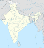
Presidency (Division)
| Presidency Division | ||
|---|---|---|
|
|
||
| State : | West Bengal | |
| Coordinates | 22 ° 34 ′ N , 88 ° 22 ′ E | |
| Administrative headquarters : | Calcutta | |
| Area : | 24,957 km² | |
| Residents : | 35.158.346 | |
| Population density : | 1,409 inhabitants / km² | |
| Districts : | 6th | |
Presidency is a division in the Indian state of West Bengal .
Districts
The Presidency Division consists of six districts :
| District | Capital | Area in km² | Population (as of 2001) | Population density in E / km² |
|---|---|---|---|---|
| Dakshin 24 Pargana | Alipur | 9,960 | 6,906,689 | 693 |
| Haora | Haora | 1,467 | 4,273,099 | 2,913 |
| Kolkata | * | 185 | 4,572,876 | 24,718 |
| Murshidabad | Baharampur | 5,324 | 5,866,569 | 1.102 |
| Nadia | Krishnanagar | 3,927 | 4,604,827 | 1,173 |
| Uttar 24 Pargana | Barasat | 4,094 | 8,934,286 | 2,182 |
* The Kolkata District only covers part of the city of Kolkata and therefore has no capital.
