
Dakshin 24 Pargana
| Dakshin District 24 Pargana দক্ষিণ চব্বিশ পরগণা জেলা |
|
|---|---|

|
|
| State | West Bengal |
| Division : | Presidency |
| Administrative headquarters : | Alipur |
| Area : | 9,960 km² |
| Residents : | 8,161,961 (2011 census) |
| Website : | s24pgs.gov.in |

The district Dakshin 24 Pargana ( Bengali দক্ষিণ চব্বিশ পরগণা জেলা ) or South 24 Parganas ("southern 24 Parganas ") is part of the Indian state of West Bengal . The capital is the city of Alipur , just a few kilometers southwest of Calcutta , which is one of the most expensive residential areas in India.
geography
The district Dakshin 24 Pargana, located in the delta of the Ganges, borders in the south on the Bay of Bengal , in the west on the Hugli river and the districts Purba Medinipur and Haora and in the north and east on the district Uttar 24 Pargana . The average height is around 5 m above sea level. d. M .; the climate is mostly humid and rainy , especially in the monsoon months from June to October. The largest cities in the district are Maheshtala (approx. 450,000), Budge Budge (approx. 80,000) and Diamond Harbor (approx. 45,000) on Hugli as well as Rajpur Sonarpur (approx. 430,000) and Baruipur (approx. 55,000) inland.
population
Official population statistics have only been kept and published since 1991.
| year | 1991 | 2001 | 2011 |
| Residents | 5,715,030 | 6,906,689 | 8,161,961 |
Hindus predominate mainly in the rural villages (about 63% of the total population); in the cities, the proportion of Muslims (approx. 35.5% of the total population) is also significant. As is usual with censuses in northern India, the male population exceeds the female share by around 5%. Approx. 75% of the people live in rural villages and only about 15% live in cities.
economy
The district is largely agriculturally oriented; the soils of the Sundarbans are fertile, but crops (mainly rice and sugar cane ) are threatened by floods and storms. Cattle breeding and fishing are also carried out on a small scale. The region around the capital Alipore is partially industrialized.
history

The fertile alluvial land in the Ganges Delta prompted people to settle down early on - settlements are archaeological as early as the 2nd / 3rd Century proven, but they were washed away again and again. During the Mughal period and under British rule , the jungle landscape was used as a hunting area. In 1757 the Bengal Nawab ceded 24 lands to the British East India Company . The British were the first to try to establish an administration in the vast area.
Attractions

- The main attraction of the district is the mangrove landscape of the Sundarbans , criss-crossed by numerous watercourses . In 1984 the 1330 km² Sundarbans National Park was established, which has become an internationally known tourist destination because of its flora and fauna ( Bengal tigers , birds, butterflies, etc.). It was recognized by UNESCO as a World Heritage Site in 1987 and forms a natural unit with the part that was placed under protection in 1997 to the east of Bangladesh .
- Approx. 5 km from the small town of Raidighi is the Jatar Deul Tower Temple, which belongs to a subgroup of the Bengali temples .

Bengal tiger
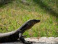
Monitor lizard


Web links
Individual evidence
- ↑ District Dakshin 24 Pargana - map + information
- ↑ Dakshin 24 Pargana District - Map with elevation information
- ↑ District Dakshin 24 Pargana - Climate tables
- ↑ District Dakshin 24 Pargana - Census 1991 to 2011
- ↑ Dakshin District 24 Pargana - Census 2011
- ↑ History of the Sundarbans
- ↑ Sundarban National Park
- ↑ Entry on the website of the UNESCO World Heritage Center ( English and French ).
- ↑ Entry on the website of the UNESCO World Heritage Center ( English and French ).

Alipurduar | Bankura | Birbhum | Dakshin 24 Pargana | Dakshin Dinajpur | Darjeeling | Haora | Hugli | Jalpaiguri | Jhargram | Kalimpong | Chef Bihar | Calcutta | Malda | Murshidabad | Nadia | Pashchim Bardhaman | Pashchim Medinipur | Purba Bardhaman | Purba Medinipur | Purulia | Uttar 24 Pargana | Uttar Dinajpur