Malda (district)
| Malda District মালদা জেলা |
|
|---|---|

|
|
| State | West Bengal |
| Division : | Presidency |
| Administrative headquarters : | English Bazaar |
| Area : | 3,733 km² |
| Residents : | 3,988,845 (2011 census) |
| Website : | Malda district |
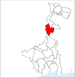
The historically significant District Malda or District Maldah ( Bengali : মালদা জেলা) is part of the Indian state of West Bengal . The capital is English Bazar .
geography
The by Mahananda , a tributary of the Ganges flowing through it, and other small rivers district Malda borders in the northwest on the district Purnia in Bihar , on the northeast by the West Bengal districts of Uttar Dinajpur and Dakshin Dinajpur , to the east by Bangladesh , on the south by the district Murshidabad and to the west to the Santhal Pargana (division) of the Indian state of Jharkhand . The average height is around 30 m above sea level. d. M .; the climate is mostly humid and especially rainy in the monsoon months from May to October.
population
Official population statistics have only been kept and published since 1991.
| year | 1991 | 2001 | 2011 |
| Residents | 2,637,032 | 3,290,468 | 3,988,845 |
Hindus dominate the rural villages (approx. 51% of the total population); the proportion of Muslims (around 48% of the total population) is roughly the same in the cities . As is customary in censuses in northern India, the male population exceeds the female share by around 10%. Approx. 86.5% of the people live in rural villages and only about 13.5% live in cities.
economy
The district is still largely agriculturally oriented; Mainly rice , wheat and mangoes but also jute are planted . There is significant silk production and processing.
history
The fertile areas along the Ganges prompted people to settle down early on, but it was only since the Middle Ages that there have been isolated sources that have become more numerous and reliable with the arrival of Islam. The old capital of the region under the Buddhist Pala dynasty (around 750–1161) and under the Hindu Sena dynasty (around 1070 – around 1205) was Gaur . The Muslim military leader Muhammad bin Bakhtiyar Khilji conquered large areas in Bengal around 1204/5, including the city of Gaur; Bengal became a province of the Sultanate of Delhi . Shamsuddin Ilyas Shah was the founder of the independent Sultanate of Bengal in the middle of the 14th century and moved the capital to Pandua ; his son Sikander Shah ruled from there from 1358 to 1390. In 1576 Bengal came under the control of the Mughal Empire , whose rule was successively replaced by the British in the 18th century .
Attractions
The main sights of the district all date from the Islamic-dominated period: These are the ruins of the Adina mosque, built around the middle of the 14th century, and the buildings of Gaur and Pandua .


