Prieto Diaz
| Municipality of Prieto Diaz | ||
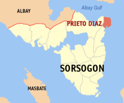
| Location of Prieto Diaz in the province of Sorsogon | ||
|---|---|---|

|
||
| Basic data | ||
| Region : | Bicol region | |
| Province : | Sorsogon | |
| Barangays : | 23 | |
| District: | 2. District of Sorsogon | |
| PSGC : | 056214000 | |
| Income class : | 5th income bracket | |
| Households : | 3623 May 1, 2000 census
|
|
| Population : | 22,442 August 1, 2015 census
|
|
| Coordinates : | 13 ° 2 ′ N , 124 ° 12 ′ E | |
| Postal code : | 4711 | |
| Mayor : | Benito Lubrica Doma | |
| Geographical location in the Philippines | ||
|
|
||
Prieto Diaz is a Filipino municipality in the province of Sorsogon . It has 22,442 inhabitants (August 1, 2015 census). The community lies at the transition from the Philippine Sea to the Gulf of Albay . In February 2012 it was announced that a wind farm with a capacity of 420 MW is to be built in the municipality.
Barangays
Prieto Diaz is politically divided into 23 barangays .
|
|
