
Bicol region
| Bicol region | |
|---|---|
  |
|
| Regional center | Legazpi |
| Residents | 5,796,989 |
| - population density | 298.1 per km² |
| surface | 18,156 km² |
| division | |
| - provinces | 6th |
| - cities | 7th |
| - Municipalities | 107 |
| - Barangays | 3,471 |
| languages | Bikolano , Masbatenyo , |
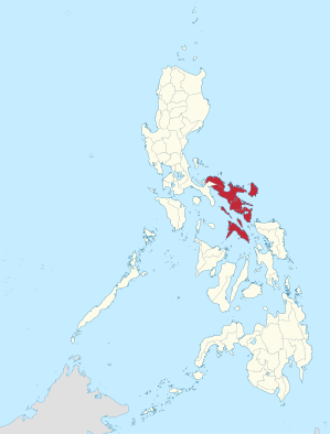
Bicol ( German : Bikol ), Kabikolan , Bicolandia or Region V is a region of the Philippines and is located on the southeastern end of the island of Luzon . Most of the people in this area speak Bikolano . The financial centers and transportation hubs of the region are Naga and Legazpi .
geography
The geographical boundaries of the Bicol Region (German: Bicol Region, also: Bikol Region) lie in the west in a line from the Bay of Lamon to the Gulf of Ragay . In the north it borders on the Philippine Sea , in it lies the archipelago of the Calaguas Islands . The largest island is Catanduanes, which is in front of the Caramoan Peninsula and both border the Gulf of Lagonoy , which is separated from Rapu-Rapu Island from the Gulf of Albay . The San Bernardino Strait borders the region in the southeast, the Samar Sea joins the province of Sorsogon in the south and the Visayas Sea in the south of Masbate . Southwest of the region is the Sibuyan Sea , the easternmost extension of which is the Bay of Sorsogon .
There are numerous volcanoes in the region , such as the Bulusan , Iriga , Isarog , Labo , Malinao , Masaraga and the volcanic mountains of the Pocdol Mountains . The most famous, however, is Mayon , which is considered to be one of the most attractive and active volcanoes in the world.
The largest river in the region is the Bicol , it flows into the San Miguel Bay and drains the central part of the peninsula. The Baao , Buhi and Bato lakes are located in its catchment area .
structure
The region is divided into the following six provinces :
- Albay (area 2,575.77 km², 1,190,823 inhabitants / 2007)
- Camarines Norte (2,320.07 km², 513,785)
- Camarines Sur (5,497.03 km², 1,693,821)
- Catanduanes (1,492.16 km², 232,757)
- Masbate (4,151.78 km², 768,939)
- Sorsogon (2,119.01 km², 709,673)
with seven cities:
- Legazpi City (in Albay)
- Ligao City (in Albay)
- Tabaco City (in Albay)
- Iriga City (in Camarines Sur)
- Naga City (in Camarines Sur)
- Masbate City (in Masbate)
- Sorsogon City (in Sorsogon)
National parks and nature reserves
- Caramoan National Park
- Mount Isarog National Park
- Mayon Volcano National Park
- Bulusan Volcano National Park
- Catanduanes Watershed Forest Reserve
- Libmanan Caves National Park
- Abasig-Matogdon Mananap Natural Biotic Area
- Bicol Natural Park
Archipelagos and islands
Significant structures
Web links
Individual evidence
- ↑ 2015 Population Counts Summary. In: psa.gov.ph. Retrieved June 4, 2016 .
Coordinates: 13 ° 30 ' N , 123 ° 18' E