Gubat
| Municipality of Gubat | ||
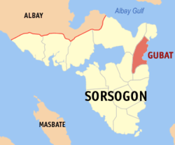
| Location of Gubat in the Sorsogon Province | ||
|---|---|---|

|
||
| Basic data | ||
| Region : | Bicol region | |
| Province : | Sorsogon | |
| Barangays : | 51 | |
| District: | 2. District of Sorsogon | |
| PSGC : | 056208000 | |
| Income class : | 2nd income bracket | |
| Households : |
May 1, 2000 census
|
|
| Population : | 59,534 August 1, 2015 census
|
|
| Population density : | 319.7 inhabitants per km² | |
| Area : | 186.20 km² | |
| Coordinates : | 12 ° 55 ' N , 124 ° 7' E | |
| Postal code : | 4710 | |
| Geographical location in the Philippines | ||
|
|
||
Gubat is a Filipino municipality in the province of Sorsogon . It has 59,534 inhabitants (August 1, 2015 census) who lived in 51 barangays . Gubat belongs to the second income bracket of the communities in the Philippines. It is located approx. 17 km east of the provincial capital Sorsogon City , on the San Bernardino Road . Its neighboring communities are Sorsogon City and Casiguran in the west, Barcelona in the south, and Prieto Diaz in the north.
Barangays
|
|
|
