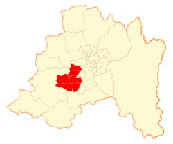
Talagante Province
| Provincia de Talagante Talagante Province
|
|
|---|---|
 |
|
| Basic data | |
| Country | Chile |
| region | Metropolitan Region of Santiago |
| Seat | Talagante |
| surface | 582.3 km² |
| Residents | 262,665 |
| density | 451 inhabitants per km² |
| ISO 3166-2 | CL-RM |
Coordinates: 33 ° 42 ′ S , 70 ° 54 ′ W
The Talagante Province is a province in the southwest of the Chilean Región Metropolitana de Santiago . It extends over a territory of 582.3 km² and has 262,665 inhabitants ( 2012 census ). The capital is the city of the same name, Talagante .
Communities
The province of Talagante is divided into five municipalities:
| local community | Area (km²) | Population (2012) |
|---|---|---|
| Talagante | 125.5 | 64,894 |
| El Monte | 118.1 | 31,468 |
| Isla de Maipo | 188.7 | 32,327 |
| Padre Hurtado | 80.8 | 50,670 |
| Peñaflor | 69.2 | 83,306 |