Przemyśl (rural municipality)
| Gmina Przemyśl | ||
|---|---|---|

|
|
|
| Basic data | ||
| State : | Poland | |
| Voivodeship : | Subcarpathian | |
| Powiat : | Przemyski | |
| Geographic location : | 49 ° 47 ' N , 22 ° 46' E | |
| Residents : | 10.161 | |
| Gmina | ||
| Gminatype: | Rural community | |
| Gmina structure: | 16 school authorities | |
| Surface: | 108.42 km² | |
| Residents: | 10,628 (Jun. 30, 2019) |
|
| Population density : | 98 inhabitants / km² | |
| Community number ( GUS ): | 1813082 | |
| administration | ||
| Wójt : | Andrzej Huk | |
| Address: | ul. Gen. Borelowskiego 1 37-700 Przemyśl |
|
| Website : | www.gminaprzemysl.pl | |
The gmina wiejska Przemyśl is an independent rural municipality in Poland in the powiat Przemyski in the Subcarpathian Voivodeship . Its seat is in the independent city of Przemyśl (German: Premissel ).
geography
Geographical location


The rural commune (Gmina) includes the city of Przemyśl in the west, south and east. It is cut in two by the city and borders Ukraine to the east . The San flows through part of the Gmina.
Community structure
Schulzenämter
- Bełwin
- Grochowce
- Hermanowice
- Krówniki
- Kuńkowce
- Łętownia
- Łuczyce
- Malhowice
- Nehrybka
- Ostrów
- Pikulice
- Rożubowice
- Stanislawczyk
- Ujkowice
- Wapowce
- Witoszyńce
Locations without a Schulzenamt
- no
- Hołubla, counts as a "further" settlement of the rural community and is a forest settlement ( osada leśna ).
history
The region became part of the Crown Land of Galicia of the Habsburg Monarchy in 1772 after the first partition of Poland . The second largest fortress in Europe after Verdun was built in Przemyśl in the middle of the 19th century . Vorwerke and forts of the outer ring were also built in the area of today's rural community. Parts of the facilities were blown up in 1915 after the siege of Przemyśl .
Polish again in 1918, the area was occupied first by German and then by Soviet troops during World War II . New fortifications were built as part of the planned Molotov Line . Recaptured by the Wehrmacht in 1941 , then by the Red Army in July 1944 , it only became Polish again in March 1945.
From 1975 to 1998 the rural community belonged to the Przemyśl Voivodeship .
coat of arms
The Gmina does not currently have a coat of arms. (As of August 2015)
Culture and sights
Buildings
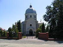
- Church in Krówniki
- Ujkowice Monastery, partly in ruins
- Church in Grochowce
- Church in Łętownia
- modern church in Ostrów, old obelisk (cross over half moon)
- School in Ostrów, former manor house
- Forts III, IV, V, VI, VIII, IX, IXa, Xb of the outer ring of the Przemyśl Fortress.
Web links
- Official website of the Przemyśl Rural Municipality (Polish)
- Fortifications of the Molotow Line in southern Poland near Sanok -Załuż- Lesko and Przemyśl.
Individual evidence
- ↑ population. Size and Structure by Territorial Division. As of June 30, 2019. Główny Urząd Statystyczny (GUS) (PDF files; 0.99 MiB), accessed December 24, 2019 .
- ↑ Rozporządzenie Ministra Administracji i Cyfryzacji z dnia 13 grudnia 2012 r. w sprawie wykazu urzędowych nazw miejscowości i ich części , Dziennik Ustaw (Polish, State Gazette) No. 200, 2013


