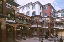
Chengguan (Karub)
The large community of Chengguan ( Tibetan ཁྲིན་ ཀོན་ རྡལ་ Wylie khrin kon rdal ; Chin. 城关 镇 ; Pinyin: Chéngguān Zhèn ) is the seat of government of the Karub district and the city of Qamdo (Chamdo). Chengguan is located in the west of the Tibetan cultural region of Kham and in the east of the Tibet Autonomous Region.
The large community is about 500 km as the crow flies from Lhasa , with a road distance of 1120 km (south route) and 1030 km (north route). at an altitude of 3230 m on the Mekong (here Za Qu / Dza Chu), which is crossed by two highways in the village. It can be reached by plane from Bamda Airport, 130 km away from Lhasa and Chengdu .
Before the construction of modern traffic routes, the tea-horse route , Chinese Cha Ma Gu Dao (茶 马 古道), crossed the river, the northern branch from Chengdu in Sichuan and the southern branch from the tea regions of Yunnan united here. Further to the west, the route crossed the upper reaches of the Saluen , reached Lhasa and from there Bengal .
Climate table
| Chengguan | ||||||||||||||||||||||||||||||||||||||||||||||||
|---|---|---|---|---|---|---|---|---|---|---|---|---|---|---|---|---|---|---|---|---|---|---|---|---|---|---|---|---|---|---|---|---|---|---|---|---|---|---|---|---|---|---|---|---|---|---|---|---|
| Climate diagram | ||||||||||||||||||||||||||||||||||||||||||||||||
| ||||||||||||||||||||||||||||||||||||||||||||||||
|
Average monthly temperatures and rainfall for Chengguan
Source: wetterkontor.de
|
|||||||||||||||||||||||||||||||||||||||||||||||||||||||||||||||||||||||||||||||||||||||||||||||||||||||||||||||||||||||||||||||||||||||||||||||||||||||||||||||||||||
Coordinates: 31 ° 8 ' N , 97 ° 11' E

