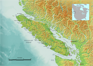
Queen Charlotte Street
| Queen Charlotte Strait Queen Charlotte Strait |
||
|---|---|---|
| Location northeast of Vancouver Island | ||
| Connects waters | Queen Charlotte Sound (Pacific Ocean) | |
| with water | Johnstone Strait | |
| Separates land mass | Vancouver Island | |
| of land mass | Mainland North America | |
| Data | ||
| Geographical location | 50 ° 53 '50 " N , 127 ° 21' 11" W | |
|
|
||
The Queen Charlotte Strait ( English Queen Charlotte Strait ) is a strait between Vancouver Island and mainland British Columbia in western Canada . She was named after Queen Charlotte , the wife of George III. named. Until 1924, when the 18th Report of the Geographic Board of Canada set the boundaries of Queen Charlotte Sound , the Königin-Charlotte-Straße was also partially referred to as Queen Charlotte Sound.
The road connects Queen Charlotte Sound in the north via Johnstone Strait and Discovery Passage with the Strait of Georgia and Puget Sound in the south.
The strait is part of the Inside Passage from Washington to Alaska .
The tidal range of Queen Charlotte Strait is usually between 2 and 6 meters.
Individual evidence
- ↑ Walker Group (# 8426) Tidal Prediction. Fisheries and Oceans Canada , accessed April 29, 2016 .

