Río Mayo (Río Patía)
| Río Mayo | ||
|
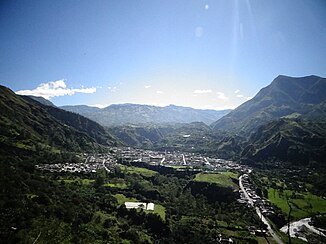
Río Mayo (bottom right in the picture) near San Pablo |
||
| Data | ||
| location |
|
|
| River system | Río Patía | |
| Drain over | Río Patía → Pacific Ocean | |
| Headwaters |
Central Cordillera , north flank of Las Ánimas 1 ° 36 ′ 39 ″ N , 76 ° 50 ′ 38 ″ W |
|
| Source height | approx. 3400 m | |
| muzzle |
Río Patía Coordinates: 1 ° 40 '53 " N , 77 ° 19' 51" W 1 ° 40 '53 " N , 77 ° 19' 51" W. |
|
| Mouth height | approx. 480 m | |
| Height difference | approx. 2920 m | |
| Bottom slope | approx. 36 ‰ | |
| length | approx. 82 km | |
| Catchment area | approx. 870 km² | |
| Drain |
MQ |
28 m³ / s |
| Small towns | La Cruz , San Pablo , Florencia | |
| Communities | Remolino | |
|
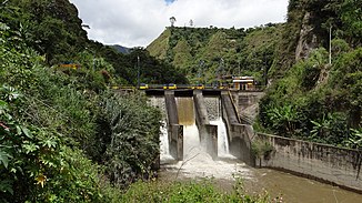
Weir on the Río Mayo below San Pablo |
||
The Río Mayo is an approx. 82 km long left tributary of the Río Patía in southwest Colombia .
River course
The Río Mayo rises at an altitude of about 3400 m in the Colombian Central Cordillera . The headwaters are located on the northern flank of the 4175 m high Las Ánimas volcano in the west of the Doña Juana-Cascabel National Park in the far east of the Departamento de Nariño . The Río Mayo initially flows 12 km to the west. Then he turns 10 km in a north-northwest direction. The small town of La Cruz is about a kilometer west of the river. The Río Mayo flows for the remaining part of about 60 km in a predominantly westerly direction. At river kilometer 55 is the small town of San Pablo on the north bank of the river. Below San Pablo, the Río Mayo flows through the approximately 10 km long Caño de Aguas Negras gorge . At river kilometer 46, the Río Mayo passes the small town of Florencia, about a kilometer to the north . At river km 36 the eastern route of the trunk road I-25 ( Pasto- Mojarras) crosses the river. In the lower 35 kilometers, the Río Mayo forms the border with the Departamento del Cauca in the north . 1.6 km above the mouth, the western route of the highway I-25 (Pasto – Mojarras) crosses the river. This finally flows north of the village of Remolino into the Río Patía coming from the north.
Hydrology
The mean discharge of the Río Mayo is 28 m³ / s. The catchment area covers an area of around 870 km².
Use of hydropower
The Hidroeléctrica del Río Mayo hydropower project is located on the Río Mayo . 2 km west of the city of San Pablo, at river km 52, the river is dammed by a weir ( ⊙ ) over a length of 700 m. The pilgrimage church of Nuestra Señora de la Playa is located on the north bank of the reservoir . A 1.6 km long pipe leads from the reservoir to a moated castle ( ⊙ ). From there, the water is fed to the power station ( ⊙ ) via a pressure line approximately 400 m long . Above the hydropower plant, the river falls largely dry over a length of 2 kilometers.
![]() Map with all coordinates: OSM | WikiMap
Map with all coordinates: OSM | WikiMap
Individual evidence
- ↑ a b Alberto Lobo-Guerrero Uscátegui: Hidrología e Hidrogeología de la Región Pacífica Colombiana (PDF, 1.2 MB) Logemin SA. 1993. Retrieved April 6, 2019.

