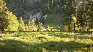
Rappinlaine
| Rappinlaine | ||
|
Rappinalm with Rappinlaine |
||
| Data | ||
| location | Upper Bavaria | |
| River system | Danube | |
| Drain over | Große Laine → Jachen → Isar → Inn → Danube → Black Sea | |
| confluence | von Rappinbach and other trenches 47 ° 38 ′ 8 ″ N , 11 ° 24 ′ 58 ″ E |
|
| Source height | approx. 1010 m | |
| muzzle |
Large Laine Coordinates: 47 ° 37 ′ 53 " N , 11 ° 26 ′ 9" E 47 ° 37 ′ 53 " N , 11 ° 26 ′ 9" E |
|
| Mouth height | 903 m | |
| Height difference | approx. 107 m | |
| Bottom slope | approx. 56 ‰ | |
| length | approx. 1.9 km | |
The Rappinlaine , in the upper reaches of the Rappinbach, is a left tributary of the Große Laine in Upper Bavaria .
The Rappinlaine arises on the southern slopes of the Rabenkopf, mainly between the Staffelalm and the Kochler Alm . After the Rappinalm , the brook has dug the deep Rappin Gorge up to its confluence with the Große Laine , with waterfalls up to 40 m high.
Web links
Commons : Side rivers of the Isar - collection of images, videos and audio files
gallery
Individual evidence
- ↑ Roughly measured on the Bavaria Atlas.

