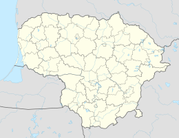
Raseiniai
| Raseiniai | ||
|
||
| State : |
|
|
| District : | Kaunas | |
| Rajong municipality : | Raseiniai | |
| Coordinates : | 55 ° 23 ' N , 23 ° 7' E | |
| Height : | 80 m | |
| Community area : | 1,573 km² | |
| Inhabitants (place) : | 11,993 (2010) | |
| Inhabitant (municipality) : | 42,363 | |
| Population density : | 27 inhabitants per km² | |
| Time zone : | EET (UTC + 2) | |
| Telephone code : | (+370) 428 | |
| Postal code : | 60150 | |
| Status: | Rajong Parish | |
| Structure : | 1 city office (core city), 1 additional city office, 10 additional districts |
|
| Postal address : | V. Kudirkos g. 5, 60150 Raseiniai |
|
| Website : | ||
|
|
||
Raseiniai (German Raseinen ; formerly Rossienie / Rossieny) is a town and administrative seat of the Rajongemeinde of the same name in Lithuania near the Kaunas - Klaipėda motorway . In the municipality it forms its own urban district ( miesto seniūnija ). Raseiniai is still very poor.
history
Heavy fighting broke out here in July 1915.
Before the German occupation in 1941 there were around 2,000 Jews in Raseiniai, that is a third of the population. They were ghettoized and shot in a massacre near Girkalnis in August 1941 .
city
The first known mention of Raseiniai comes from the year 1253. Here is a former Dominican monastery.
Personalities
- Simas Ramutis Petrikis (* 1942), engineer and politician
- Vytautas Zigmas Vaitonis (* 1942), chess player
- Petras Čėsna (* 1945), manager and politician
- Nijolė Sabaitė (born 1950), athlete
- Jonas Sąlyga (* 1954), internist, professor and politician
- Rimvydas Vaštakas (* 1960), manager and politician
literature
- Raseiniai , in: Guy Miron (Ed.): The Yad Vashem encyclopedia of the ghettos during the Holocaust . Jerusalem: Yad Vashem, 2009 ISBN 978-965-308-345-5 , pp. 646f.
Individual evidence
- ↑ see the list of cities in Lithuania as well as the battle calendar of German divisions in the First World War


