Rawlins, Wyoming
| Rawlins | ||
|---|---|---|
 Road through Rawlins |
||
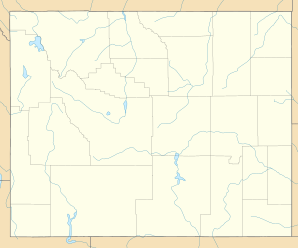
| Location in Wyoming | ||
|
|
||
| Basic data | ||
| State : | United States | |
| State : | Wyoming | |
| County : | Carbon County | |
| Coordinates : | 41 ° 47 ′ N , 107 ° 14 ′ W | |
| Time zone : | Mountain ( UTC − 7 / −6 ) | |
| Residents : | 8,538 (as of: 2000) | |
| Population density : | 444.7 inhabitants per km 2 | |
| Area : | 19.2 km 2 (approx. 7 mi 2 ) of which 19.2 km 2 (approx. 7 mi 2 ) is land |
|
| Height : | 2083 m | |
| Postal code : | 82301 | |
| Area code : | +1 307 | |
| FIPS : | 56-63900 | |
| GNIS ID : | 1593213 | |
| Website : | www.rawlins-wyoming.com | |
Rawlins is a place and county seat of Carbon County in the US state of Wyoming .
geography
Rawlins covers an area of 19.2 km² (7.4 mi²), which does not include any body of water. The city is at an altitude of 2073 m above sea level.
Demographics
As of July 1, 2004, Rawlings had 8,633 residents.
age structure
| population | Years | proportion of |
|---|---|---|
| under | 18th | 26.00% |
| from | 18 - 24 | 10.10% |
| from | 25-44 | 29.40% |
| from | 45-64 | 24.20% |
| over | 65 | 10.30% |
- The average age is 36 years.
Facilities
The Wyoming State Penitentiary is located in Rawlins , a maximum security prison for about 800 inmates. It opened in 1901 and moved to a new building in 1980. The old building, also known as Wyoming Frontier Prison , was added to the National Register of Historic Places in 1983. The State Penitentiary was also used to carry out Wyoming's death sentences, most recently in 1992.
Web links
Commons : Rawlins (Wyoming) - Collection of images, videos, and audio files
Individual evidence
- ↑ Wyoming State Penitentiary , accessed November 18, 2018
- ^ National Register of Historic Places: Wyoming State Penitentiary , accessed November 18, 2018
